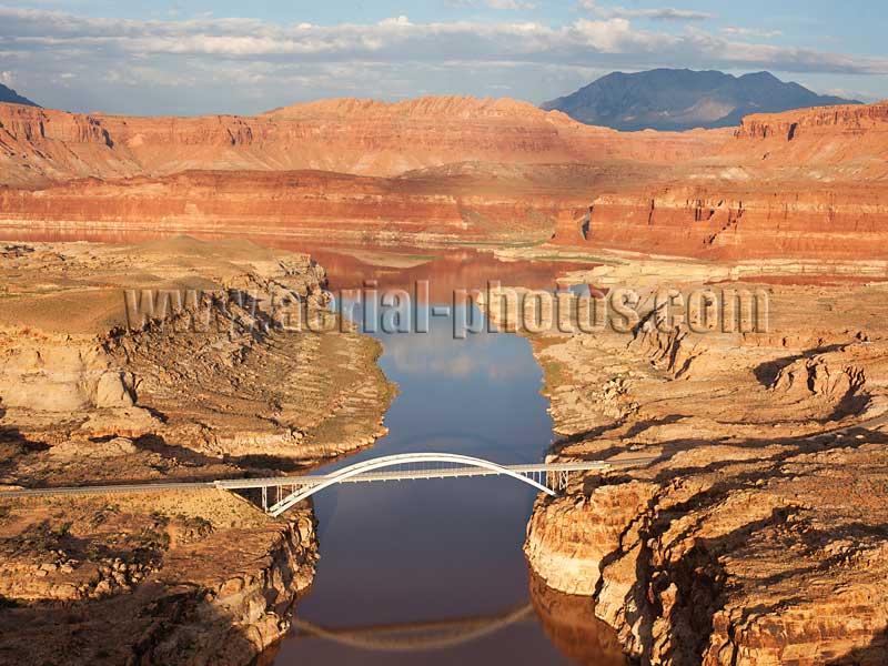
Hite Crossing Bridge is located in a remote location in the middle of the Colorado Plateau. Opened to traffic in 1966, it has allowed access to some of the wildest places in the country. It is the only bridge on the Colorado River for 405 kilometers (252 miles) between Moab, Utah and Page, Arizona. Lake Powell, Garfield / San Juan Counties, Utah, United States.
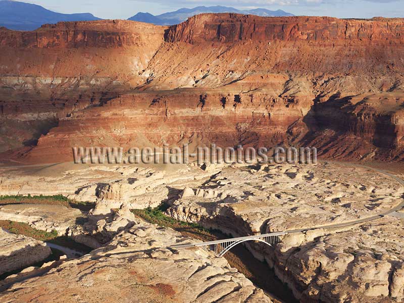
Dirty Devil Bridge is in a remote location on the Colorado Plateau, not far from the Hite Crossing Bridge. The bridge crosses the Dirty Devil River (a tributary of the Colorado River) or Lake Powell when at maximum capacity—the white calcium carbonate stripe visible under the bridge indicates the maximum level of the lake. Lake Powell, Garfield County, Utah, United States.
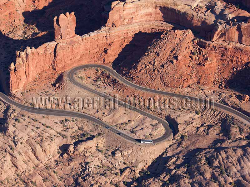
This scenic winding road within Arches National Park is the access road to the world’s greatest concentration of natural arches. Over 2000 arches have been catalogued in an area of only 310.30 km2 (119.811 sq. mi.), the largest is 93 meters wide (306 feet). The lofty red cliff above the road is the Entrada Sandstone of Jurassic age in which the arches were formed. Arches National Park, Grand County, Utah, United States.
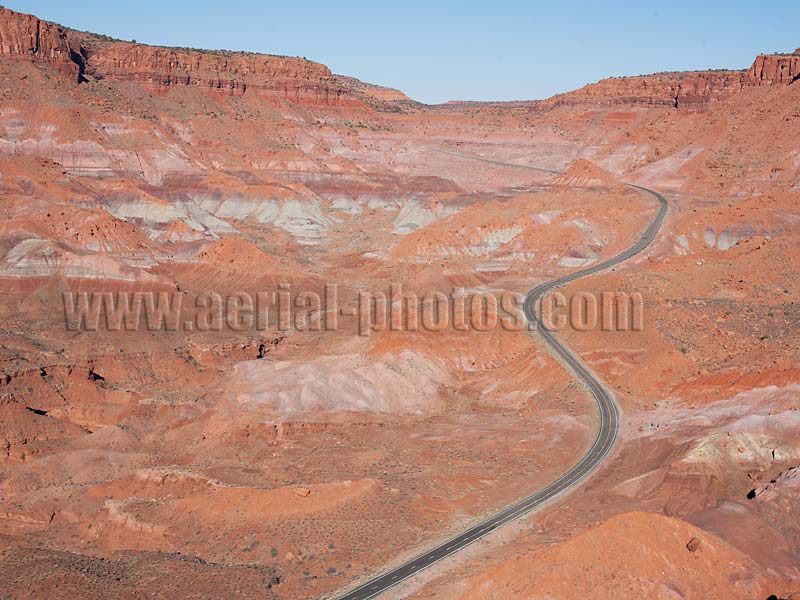
Scenic road 276 winding its way through a desert landscape with a profusion of red hues. This road, which leads to Clay Hills Pass, was built in 1880 by Mormon pioneers who had to cut through solid rock. Clay Hills, San Juan County, Utah, United States.
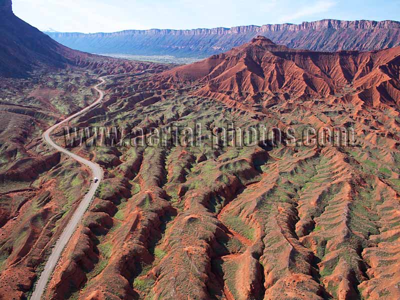
The access road to Castle Valley (a ranching community founded by Mormon pioneers) goes through some spectacular badlands. The mesas and buttes there are reminiscent of those in monument valley. Numerous classic westerns such as Rio Grande and Cheyenne Autumn were shot in the vicinity. Castle Valley, Grand County, Utah, United States.
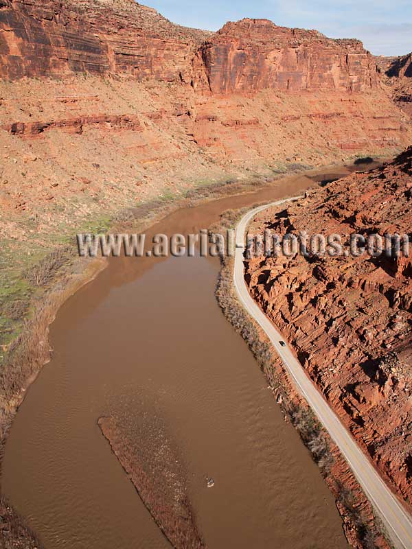
Upstream of Moab, Highway 128 Scenic Byway follows the Colorado River through some of the most spectacular sceneries of the American West. Moab, Grand County, Utah, United States.

Utah State Route 95 on the right bank of Lake Powell. Garfield County, Utah, United States.
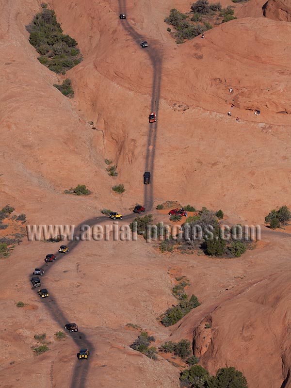
Jeep excursion on Moab's popular Hells Revenge Trail. It is a difficult trail, only for experienced 4x4 drivers. It is approximately 10 kilometrers in length, mostly on sandstone. The gradient in some places is very impressive, but fortunately, the sandstone provides good traction for the tires. Many of the trails surrounding Moab were built in the 1950s when uranium mines were opened. Moab, Grand County, Utah, United States.
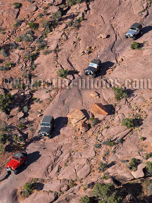
Jeep excursion on the Moab Rim Trail. It is a difficult trail to negotiate as it starts from the Colorado River as a 20% grade with high sandstone ledges to overcome for the first 1.6 kilometers. The area around Moab is a wonderland for off-road explorations with hundreds of kilometers of trails in one of the American West’s most spectacular landscape. Moab, Grand County, Utah, United States.

Badlands and Junk Yard. Caineville, Wayne County, Utah, United States.
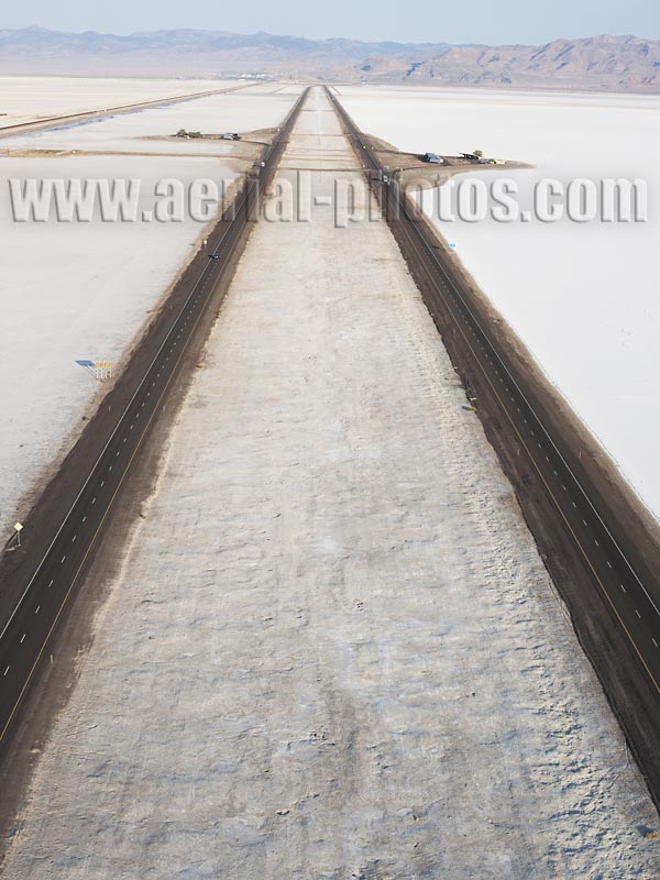
Interstate 80 westbound, it crosses the Great Salt Lake Desert (elevation: 1288m), a natural salt deposit. Tooele County, Utah, United States.

North of Interstate 80 are the Bonneville Salt Flats, which are famous for many land speed records that have been broken on the hard salty crust since 1914. Great Salt Lake Desert, Tooele County, Utah, United States.
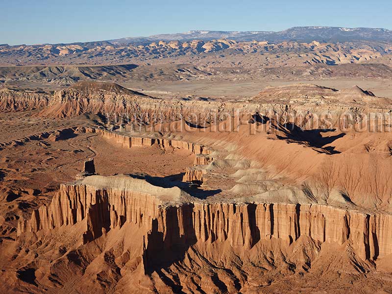
Southern Utah offers an incredible variety of Landscapes. Desert landscape in the foreground near Caineville, petrified sand dunes and deep canyons further away in Capitol Reef National Park, and dense forest of larch trees on the horizon at Dixie National Forest on the Aquarius Plateau. Caineville, Wayne County, Utah, United States.
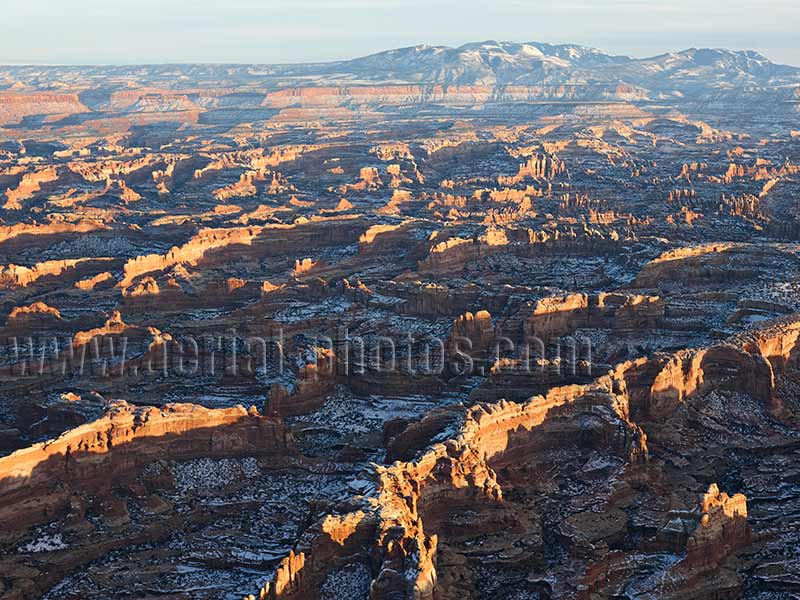
Canyonlands National park is one of the mighty five national parks of Utah. The approximate center of the park is at the confluence of the Colorado and Green rivers, which creates 3 distinct districts. The Needles District is named for the red and white banded rock pinnacles. This is a rugged terrain where hiking is the only way to reach the numerous rock formations. San Juan County, Utah, United States.
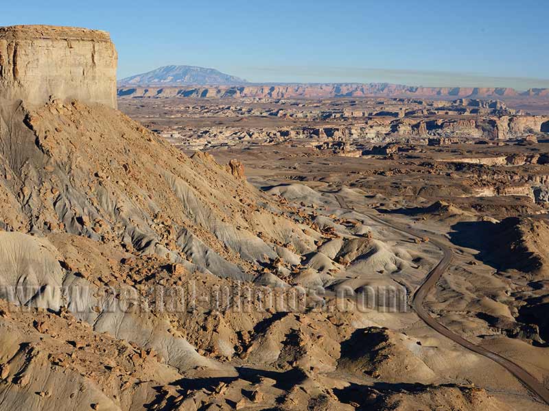
Badlands near the hamlet of Big Water. In the distance, Navajo Mountain (3154m) which is sacred to the Navajo People can be seen. To the right of the mountain, smoke from the coal-fired Navajo Generating Station rises into the air. Kane County, Utah, United States.

Corona Arch is a beautiful sandstone arch near Moab. Popular with hikers, it is easily accessible via a 2.4-kilometer hiking trail. And for those in search of an adrenaline rush, they can make a rope swing under the arch with a start from the side cliff at a height close to the arch’s top to gain a lot of speed. Moab, Grand County, Utah, United States.
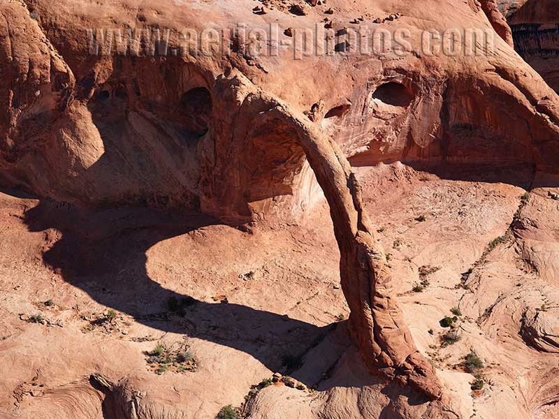
Corona Arch is 43-meter high and 32-meter wide, being this large and freestanding, people have been flying through it. In the 1980s, Tim Martin was the first to fly through it, he did so in a Cessna 172. Lately, many people have flown through it with paramotors. Moab, Grand County, Utah, United States.
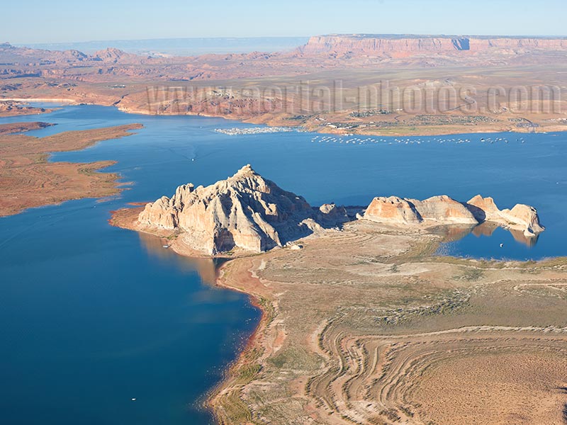
Wahweap Bay in Lake Powell. Kane County, Utah, United States.
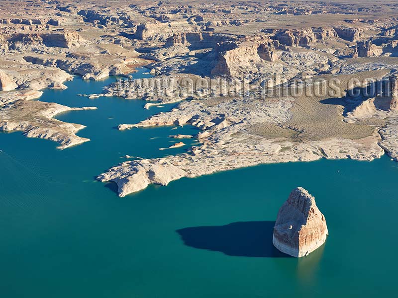
Lake Powell is a man-made reservoir on the Colorado River. Since the construction of the Glen Canyon Dam in 1963, the water level of Lake Powell has fluctuated considerably. A whitish mineral deposit on Lone Rock marks the maximum water level. Sometimes, when the water level is extremely low, the massive monolith is no longer an island. Kane County, Utah, United States.

At Kennecott Utah Copper's Garfield Smelter, copper is extracted from ore. This ore, in slurry form, was transported through a 27-kilometer-long pipeline from the Bingham Canyon Mine. The 370-meter-high smokestack disperse exhaust gases from the smelter. The smelter is located between the Oquirrh Mountains and the southern shores of the Great Salt Lake. Salt Lake County, Utah, United States.


