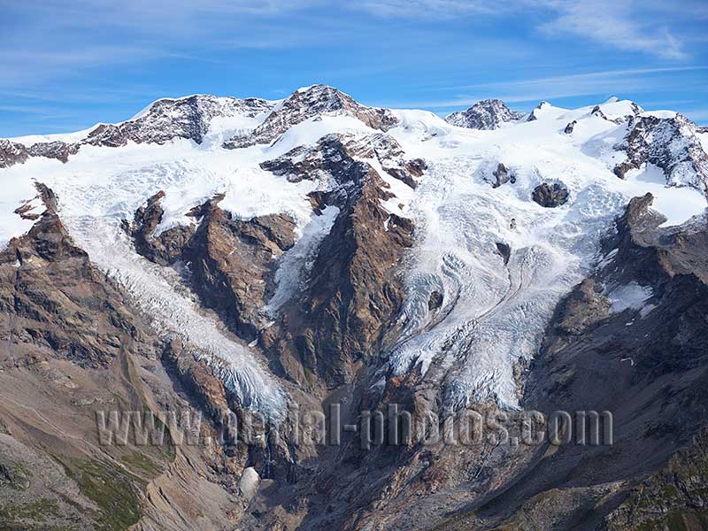
Monte Rosa Massif with the south-facing Lys Glacier. At 4634 meters above sea level, Dufourspitze (rocky peak right of middle) is the Alps’ second highest summit after Mont Blanc which reaches a height of 4810 meters. Although this photo shows the Italian side of the Monte Rosa Massif, Dufourspitze is in Switzerland. Gressoney-La-Trinité, Aosta Valley, Italy.
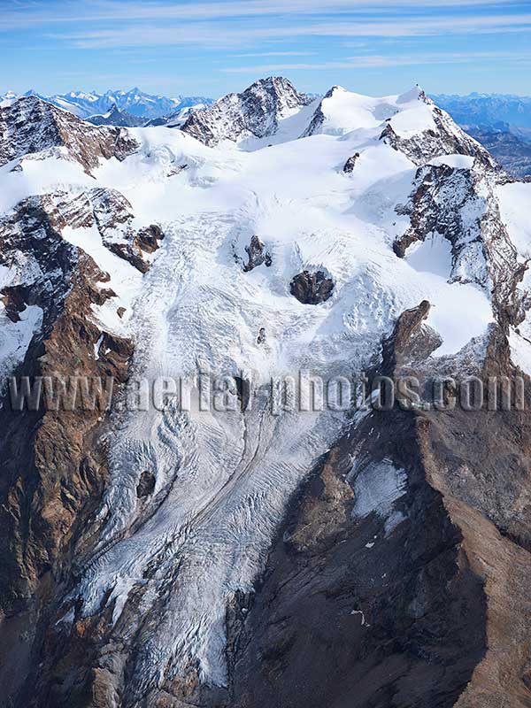
As of 2023 (photo), the Lys Glacier is still impressive for a south-facing glacier with a length of about 4.2 kilometers, but it is also retreating due to global warming. On the northern slopes of Monte Rosa, the Grenz Glacier or Gornergletscher in German is about 12.5 kilometer-long (as measured from a 2017 satellite image). Gressoney-La-Trinité, Aosta Valley, Italy.
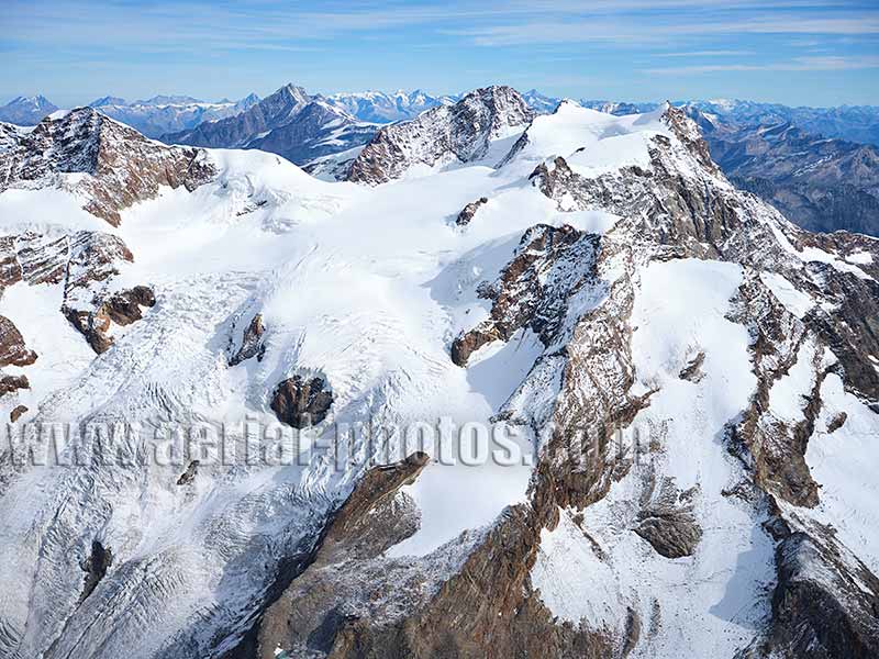
The upper Lys Glacier on the Italian side of the Monte Rosa Massif starts near the summit of the Dufourspitze. The Lys Glacier feeds into the Po basin. To the left, and at a distance of approximately 17.5 kilometers from the Dufourspitze, the Dom (elevation: 4545 meters) in Switzerland can be seen. Gressoney-La-Trinité, Aosta Valley, Italy.
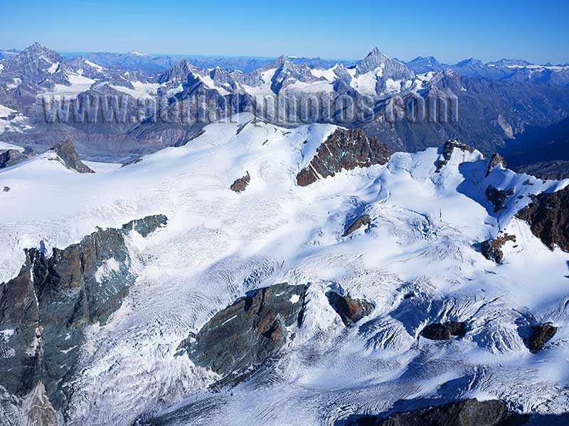
Italian side of Breithorn (elevation: 4164m) and its south facing glacier. On the left where the glacier flattens out, is the Breithorn Plateau. This plateau, straddling the Italian / Swiss border is reachable, either from Breuil-Cervinia (Italy) or Zermatt (Switzerland) with Europe’s highest ski lift: 3899m at Gobba di Rollin. This site is called Matterhorn Glacier Paradise. It offers 365 days a year of skiing on Europe’s largest summer ski area with 21 km (360 km in winter) of groomed ski runs in a truly spectacular landscape. In the distance, slightly above the horizon line is the Weisshorn summit (elevation: 4506m). Ayas, Aosta Valley, Italy.
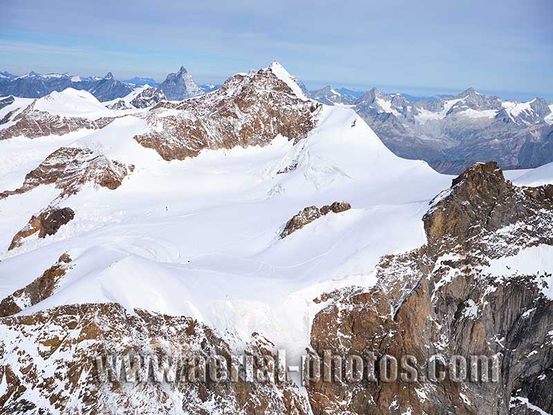
Lyskamm is a 4533-meter-high peak in the western Monte Rosa Massif. In the distance, left of Lyskamm, the Matterhorn can be seen. The Lyskamm summit was reached for the first time in 1861 by a party comprised of English men and their Swiss guides. Although this climb is not particularly difficult, it is dangerous due to its “breakable” cornices and avalanches. The mountain is nicknamed Menschenfresser, German for “man-eater”. Gressoney-La-Trinité, Aosta Valley, Italy.
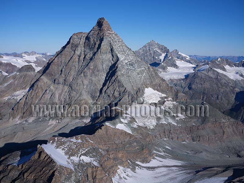
Undoubtedly Matterhorn / Cervino (elevation: 4478m) is the most known mountain, physiognomically due to its massive near perfect pyramidal shape. Its summit was reached for the first time in 1865 by a party of seven led by Edward Whymper. This aerial view from the east shows the Furggen Ridge which separates the Aosta Valley in Italy (left of ridge) from the Canton of Valais in Switzerland. The Furggen Ridge also separates the drainage basin of the Po to the Adriatic Sea (left of ridge) from the basin of the Rhône to the Mediterranean Sea. Breuil-Cervinia, Aosta Valley, Italy / Zermatt, Canton of Valais, Switzerland.
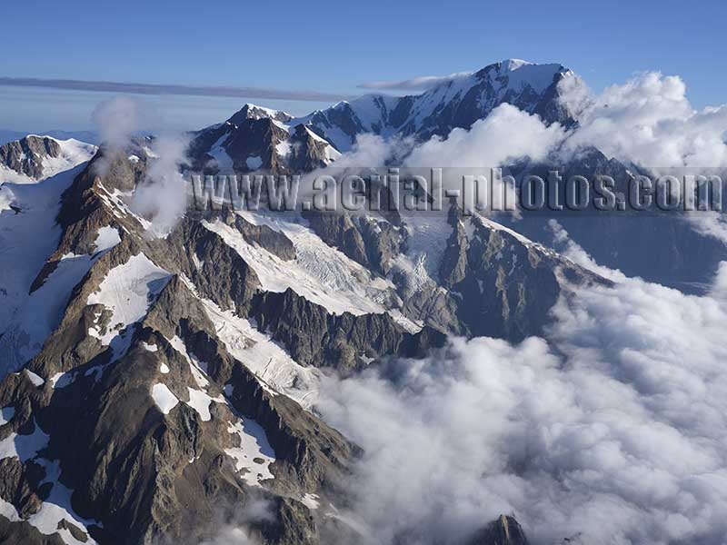
Italian side of the southern Mont Blanc Massif from Aiguille de Tré de la Tête (elevation: 3846 meters) to Mont Blanc (elevation: 4807 meters). Val Veny, Courmayeur, Aosta Valley, Italy.
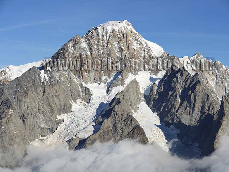
Viewed from the southeast, the summit of Mont Blanc is very much different than when viewed from the northwest; it is steeper, rockier and with much smaller glaciers. Val Veny, Courmayeur, Aosta Valley, Italy.
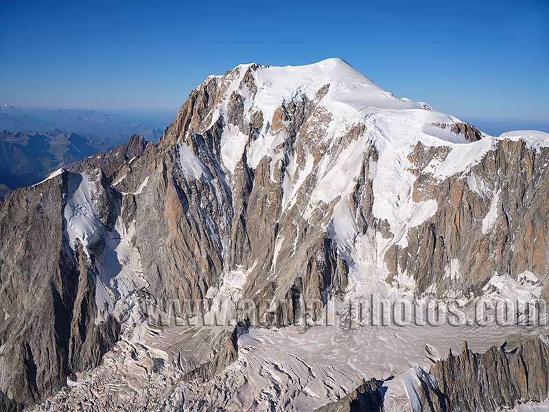
Mont Blanc with the upper Brenva Glacier. Val Veny, Courmayeur, Aosta Valley, Italy.
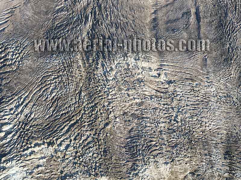
Brenva Glacier with its dirty ice of the late summer. Val Veny, Courmayeur, Aosta Valley, Italy.
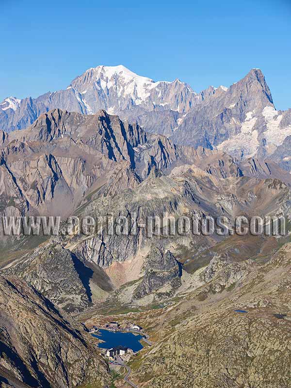
At the Great St Bernard Pass (elevation: 2469 meters), the international border between Italy and Switzerland split the lake in half. The most distant half of the lake all the way to the lofty Mont Blanc (elevation 4810 meters) and the Grandes Jorasses (elevation: 4208 meters) is in Italy. On the Swiss side of the lake, the historic Great St Bernard Hospice was founded in 1045, it is at the highest point of the road at an elevation of 2473 meters. The entire lake feeds into the Po Plain. Aosta Valley, Italy.
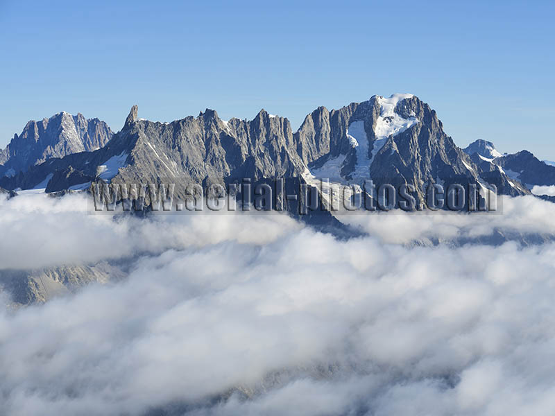
This formidable barrier is the Italian side of the Grandes Jorasses, high above the Val Ferret, hidden here by a sea of clouds. Its southeastern orientation explains the rockier appearance and the smaller glaciers. The Aiguille Verte can be seen on the left in the distance. Courmayeur, Val Ferret, Aosta Valley, Italy.
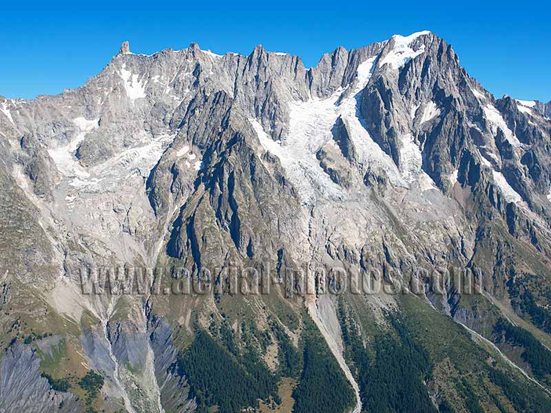
The Dent du Géant (elevation: 4014 meters) to the Grandes Jorasses (elevation: 4208 meters) ridgeline separates two watersheds and two countries: the Po basin in Italy and the Rhône basin in France. Val Ferret, Aosta Valley, Italy.
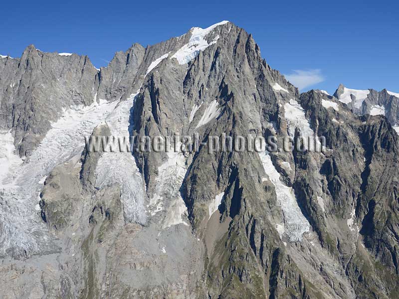
At an elevation of 4208 meters, Pointe Walker is the highest peak of the Grandes Jorasses. Its first ascent was led by Horace Walker in 1868. in 1865, famed mountain climber, Edward Whymper had reached the second highest peak, Pointe Whymper (4184 meters) which is adjacent to Pointe Walker. Courmayeur, Aosta Valley, Italy.
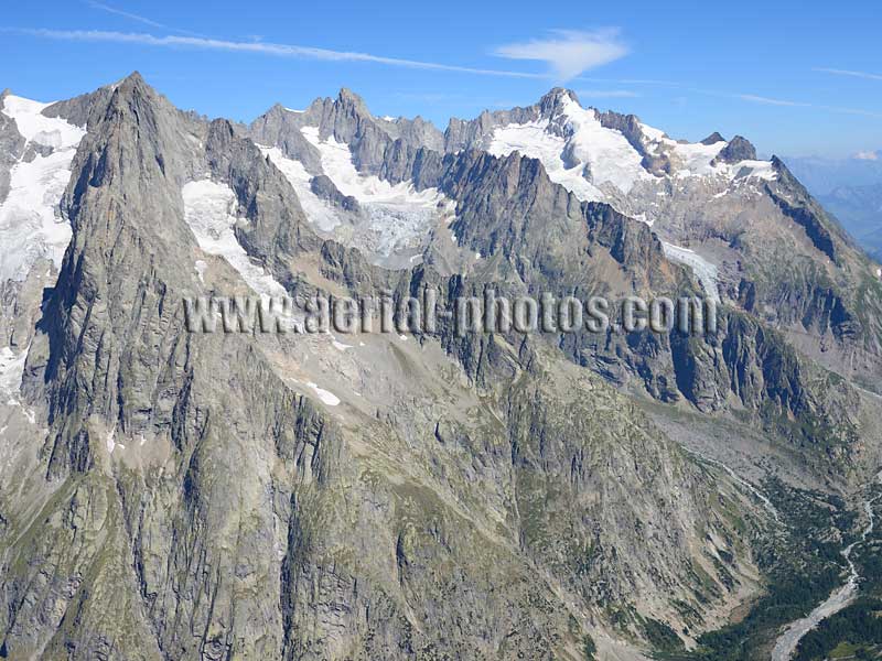
Left to right: Aiguille de Leschaux (3859 meters), Aiguille de Triolet (3870 meters) and Mont Dolent (3820 meters) overlooking Val Ferret by an impressive two kilometers of vertical drop. Courmayeur, Aosta Valley, Italy.
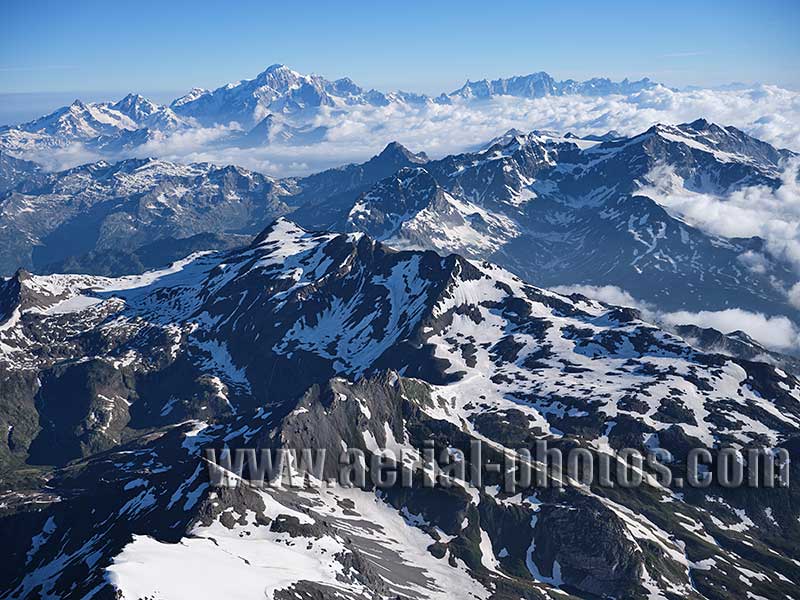
The upper Valgrisenche in late june with, at a distance of about a dozen kilometers to the right, Testa del Rutor (elevation:3486 meters). Mont Blanc and Grandes Jorasses can be seen in the distance. La Thuile, Aosta Valley, Italy.
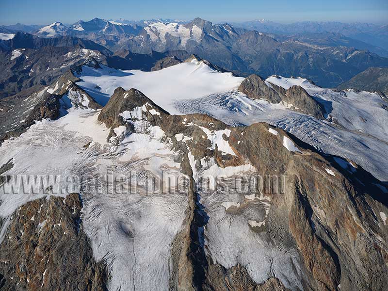
Testa del Rutor (elevation: 3486 meters). The Vanoise Massif with Mont Pourri (elevation: 3779 meters) and its glaciers can be seen in the distance. La Thuile, Aosta Valley, Italy.
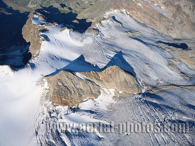
Del Rutor Glacier on the north-facing slope of Testa del Rutor with in its center “les Vedettes du Rutor” (elevation: 3329 & 3236 meters). La Thuile, Aosta Valley, Italy.
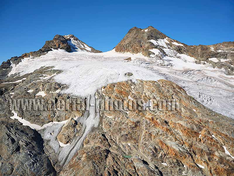
Retreating Glacier on the northeasterly slope of Testa del Rutor revealing a polished rock of various colors. La Thuile, Aosta Valley, Italy.


