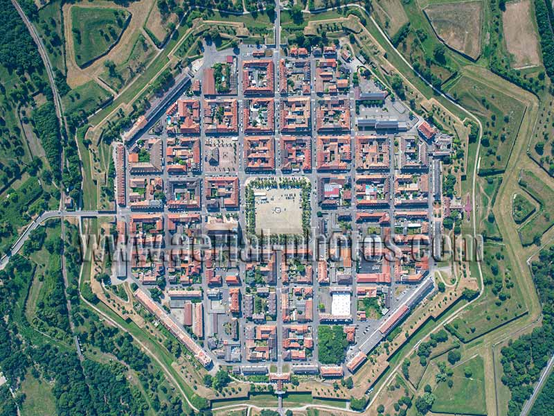
Between the Vosges Mountains and the Black Forest, the Rhine River was a disputed frontier for centuries. When Louis XIV lost the city of Breisach on the eastern bank of the Rhine at the Treaty of Ryswick in 1697, he commissioned his famed architect, Vauban, to construct a town from scratch west of the Rhine to protect the new frontier from the Holy Roman Empire—in 1648, Breisach had been given to France by the Treaties of Westphalia. The construction of Neuf-Brisach (New Brisach) started in 1698, 3 kilometers west of Breisach. 4000 men worked for 4 years to build the town and the fortified walls. Haut-Rhin, Alsace, Grand Est, France.
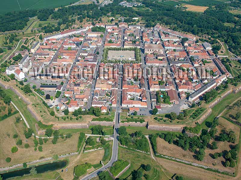
Only the view from the air will show Neuf-Brisach’s trademark: the town’s striking geometric lines with its octogonal shape within concentric star-shaped earthworks. The town has 48 quarters within a complex system of 17 kilometers of defensive walls. These walls are built with pink sandstone quarried in the Vosges Mountains and brought to the site by a canal specially dug for the occasion. The town was damaged during World War 2 by allied bombing and was restored to the exact original plan. The town of Neuf-Brisach as well as eleven other sites, all designed by Vauban, are listed as Unesco World Heritage Sites. Haut-Rhin, Alsace, Grand Est, France.
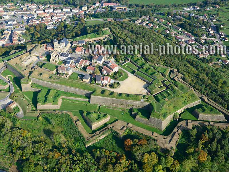
One of the largest fortress in France, the Citadel of Montmédy dates back to 1545 when the area was the Spanish Netherlands under the reign of the emperor Charles V, it was then a defensive site against France. In 1657, it became French after a siege under the reign of King Louis XIV. The fortress was substantially altered by King Louis XIV's famed military architect Vauban. The citadel was also reworked by General Séré de Rivières between 1877 and 1872. Meuse, Grand Est, France.
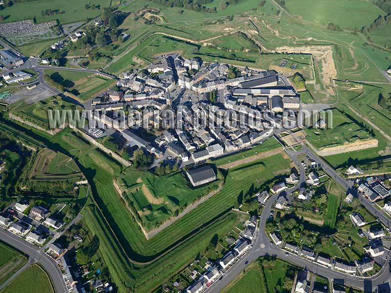
The original military fortification of Rocroi was built during the reign of Henry II of France in the mid-fifteenth century. Architecturally, it is a bastion: it has five protruding corners so as to allow defensive fire from several directions. The street layout is radial from the central plaza. Ardennes, Grand Est, France.
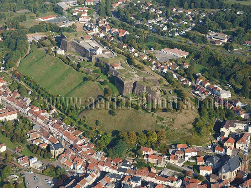
The Citadel of Bitche can be traced back to at least the thirteenth century. The site was chosen because of its strategic position atop a 500-meter-long isolated hill. The military architects Vauban (from 1680 to 1683) then Cormontaigne (from 1740 to 1754) designed the fortifications we see today. Moselle, Grand Est, France.
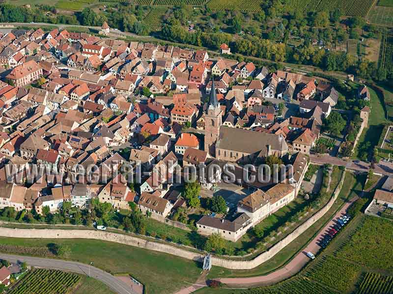
Bergheim is a remarkably well-preserved medieval town entirely surrounded by ramparts from the fourteenth century. The town is at the foothills of the Vosges Mountains on the Plain of Alsace in a landscape of vineyards. The town, listed as one of “the most beautiful village of France” was also elected “the favorite village of the French” in a yearly TV show in 2022. Haut-Rhin, Alsace, Grand Est, France.
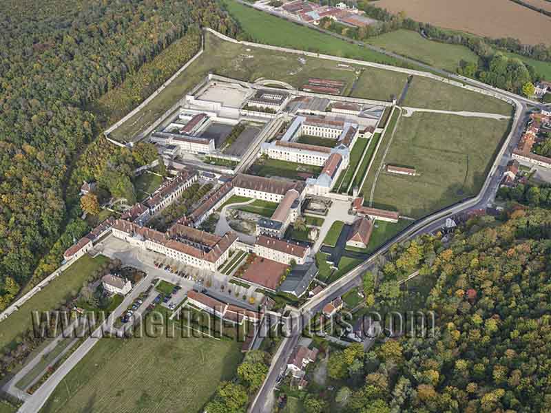
The Cistercian Abbey of Clairvaux was founded in 1115. It was an influential abbey until the French Revolution. The abbey was transformed into a prison in the early nineteenth century under the reign of Napoleon. As of 2021 (photo) this large complex functions as an abbey (buildings in the front) and as a high-security prison (buildings in the back). Ville-sous-la-Ferté, Aube, Grand Est, France.
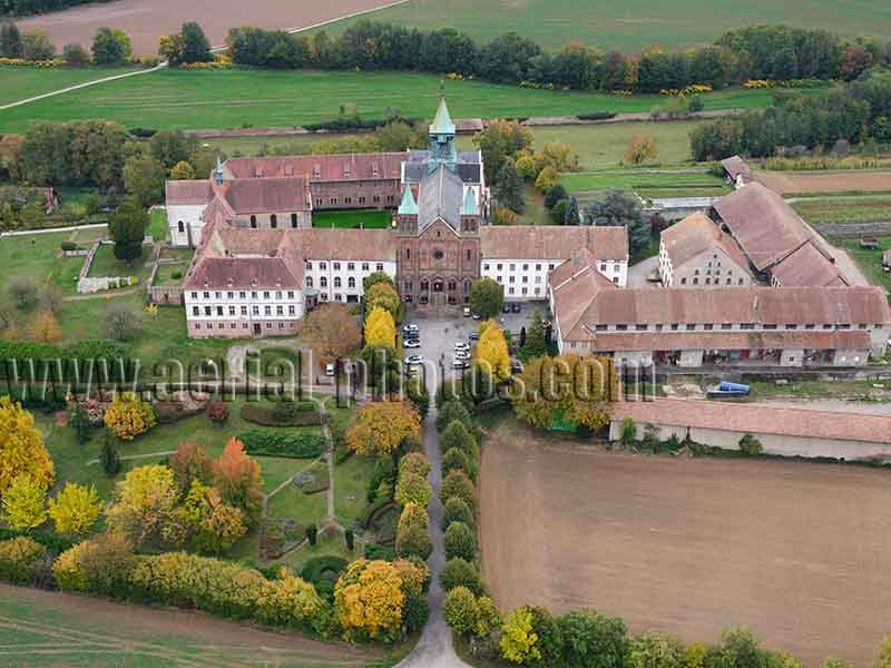
The Abbey of Notre-Dame d’Oelenberg is an important site of the Alsatian religious heritage. It is located in the Plain of Alsace near the town of Mulhouse. Its origin dates back to 1046 when a priory was founded by Heilwige de Dabo, Countess of Eguisheim and mother of Pope Leo IX. In 1825, the abbey became Cistercian when monks returned from exile. There are very few remnants of the original buildings as the abbey was substantially damaged in both World Wars. The abbey was added to the historic monuments register in 1992. Reiningue, Haut-Rhin, Alsace, Grand Est, France.
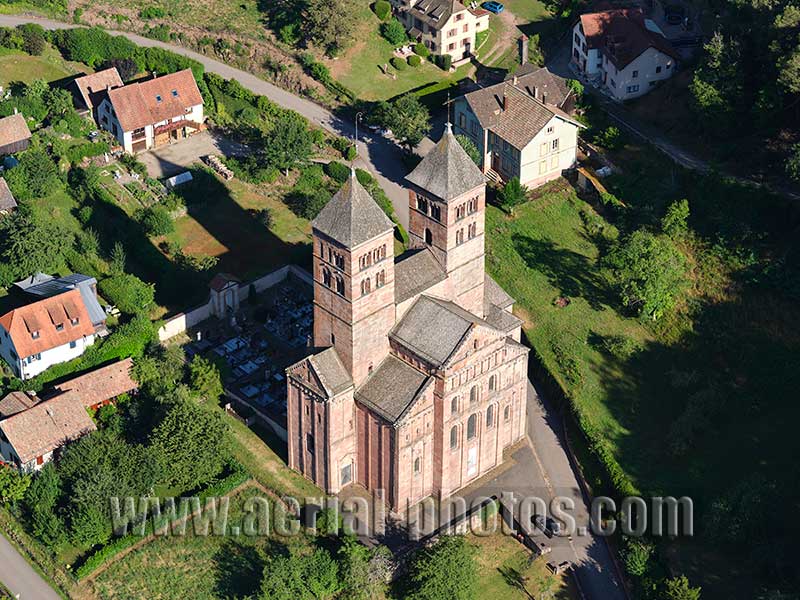
The Abbey of Murbach was founded in 728 by St. Pirmin, a benedictine monk who had already founded in 724 the Abbey of Reichenau on an island on Lake Constance. St. Pirmin had benefited from the financial help of Count Eberhard. The abbey was one of the most prosperous in the Holy Roman Empire, especially from the 12th to the 16th century. During the Thirty Years’ War (1618 to 1648) the abbey was devastated and after the conflict, it became French when Alsace was ceded to the Kingdom of France under the reign of Louis XIV. In 1759, the abbey was transferred to Guebwiller and lost its importance. Murbach. Haut-Rhin, Alsace, Grand Est, France.
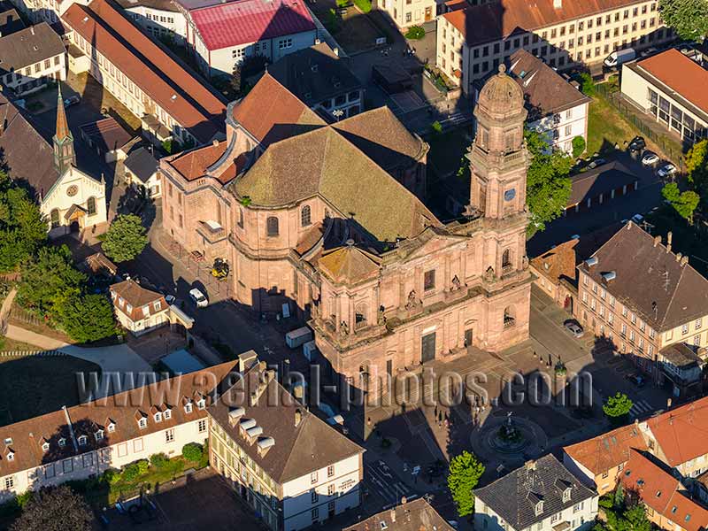
The Church of Notre-Dame of Guebwiller was built in the late 18th Century following the secularization of Murbach Abbey, 5 kilometers away. The neoclassical architecture is the work of Louis Beuque from Besançon. In 1769, he was replaced by Gabriel Ignaz Ritter, an architect from Austria, who completed the construction. The north steeple was built in the mid 19th Century, the south steeple has never been built. It is listed as a historic monument since 1841. Guebwiller, Haut-Rhin, Alsace, Grand Est, France.
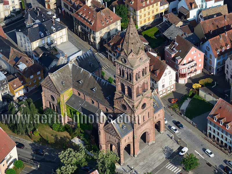
The town of Munster, which gave its name to the famous cheese produced locally, is located in the Fecht Valley in the heart of the Vosges Mountains. The Ballons des Vosges Regional Nature Park is headquartered in this town. In the Old Town, the most remarkable building is the Protestant Church. It was built between 1867 and 1873 with the pink sandstone from nearby quarries. The stork, the emblematic bird of Alsace, saw a reintroduction program take place in Munster. Two couples have taken up residence on the church’s roof and have left their abstract marks on it. Munster, Haut-Rhin, Alsace, Grand Est, France.
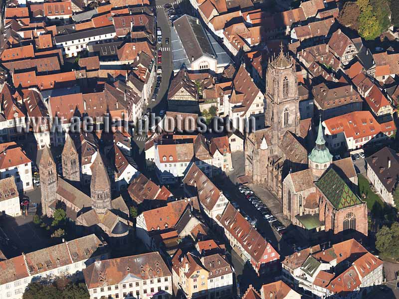
Two remarkable religious monuments stand in the historic center of Sélestat; on the left, St. Faith Church with its romanesque architecture was built in the second half of the twelfth century and on the right, St. George Church with its gothic architecture was built between the early thirteenth century and the early fifteenth century. Sélestat, Bas-Rhin, Alsace, Grand Est, France.
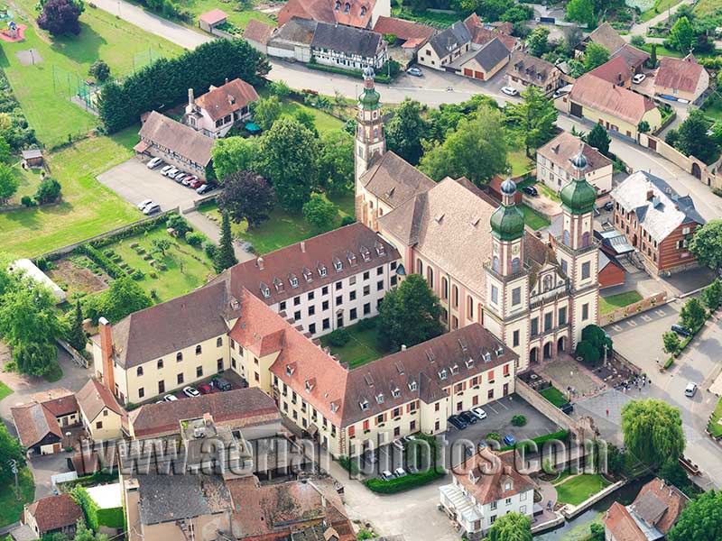
The Abbey of Ebersmunster was founded in the 7th century. At the beginning of the 12th century a Romanesque church was built, but it was burnt down in 1632 by Swedish troops during the Thirty Years' War. It was rebuilt in 1712 by the Austrian architect Peter Thumb in the German Baroque style. It was burnt again in 1717, this time by lightning, and was once again rebuilt in the same Baroque style. Inside the abbey church of St. Mauritius, marvels of craftmanship await visitors with the highly decorative paintings of its vaults and the magnificent Silbermann organ of 1730. The abbey was classified as a historic monument in 1898. Ebersmunster, Bas-Rhin, Alsace, Grand Est, France.
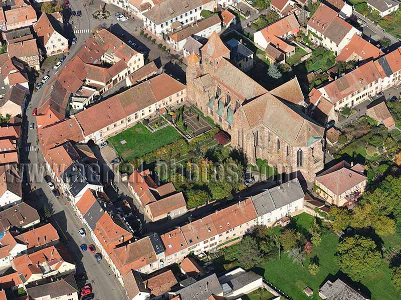
The history of the Marmoutier Abbey dates back to the 6th century when it was founded by Irish monks. The Romanesque and Gothic architecture we see today was built in the 12th century with different elements added over the next two centuries. It was a period of prosperity, but it began to decline with the German Peasants’ War of 1525 and the Thirty Year’s War of 1618-1648. The abbey saw a revival when the Alsace region was transferred to France in 1648, it lasted until the French Revolution (1789 to 1799) which saw the dissolution of the abbey. Marmoutier, Bas-Rhin, Alsace, Grand Est, France.
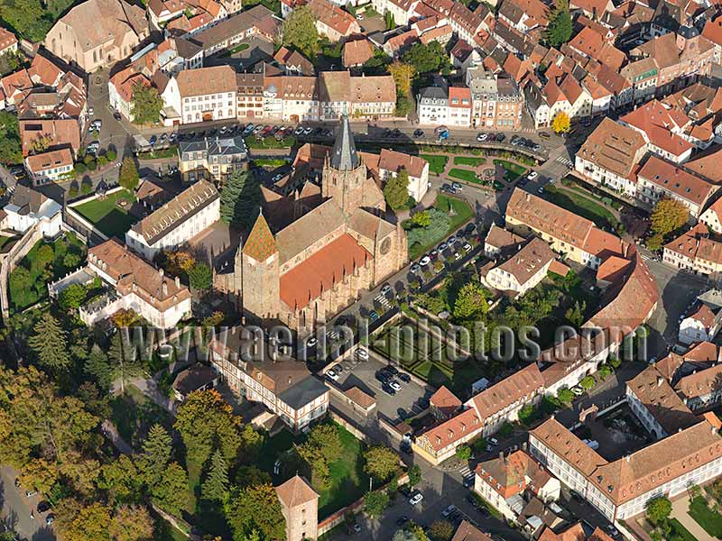
The Abbey of St. Peter and St. Paul was founded around 630-660. The current church was built between the 13th and the 14th centuries. From the previous church with romanesque architecture, only the steeple has been preserved, it dates back to the 11th century. The Church has been listed as a historic monument since 1930. Wissembourg, Bas-Rhin, Alsace, Grand Est, France.
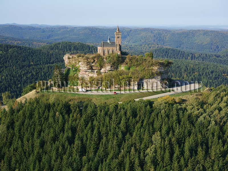
The Rocher de Dabo is a sandstone butte crowning the Schlossberg (German for mountain castle). From its top, at an elevation of 664 meters, a wide vista unfolds over the Vosges forest. Similar sandstone buttes above wooded hills are plentiful in these mountains, if large enough, all of them will have a medieval castle built on them. There used to be a castle atop this butte (hence the name Schlossberg) but it was destroyed by the troops of King Louis XIV in 1679. Built in 1889, the current chapel is dedicated to Pope Leo IX (papacy in Rome from 1049 to 1054) who was born in the area. Moselle, Grand Est, France.
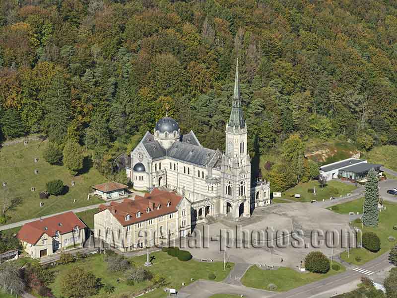
The Bois-Chenu Basilica, also known as Sainte-Jeanne-d’Arc Basilica, is dedicated to Joan of Arc. It was built close to where the shepherdess Jeanne would have heard her voices. The basilica is located on a wooded hillside above the Meuse Valley near the village of Domrémy-la-Pucelle where she was born circa 1412. The foundation stone was laid in 1881, and the building completed in 1926. It was classified as a historic monument in 2013. Vosges, Grand Est, France.
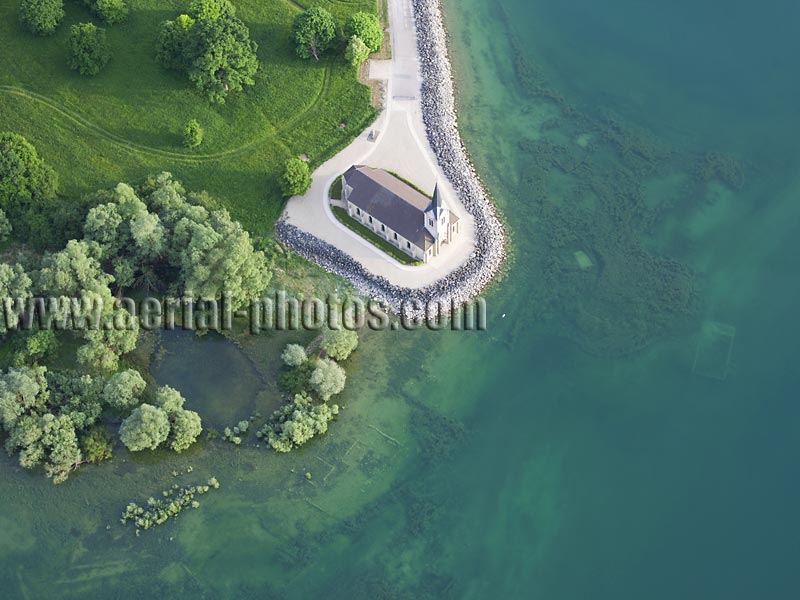
Lake of the Der is an artificial lake inaugurated in 1967, it covers a surface of 48km2. The water from the Marne River feeds into the lake through a canal. It was built as a way to prevent flooding to the cities downstream, primarily Paris—the Marne River is a tributary of the Seine River. Following the rising waters of the newly built reservoir, three villages were submerged; Saint-Laurent Church on the lakeside is what remains of the village of Champaubert-aux-Bois. Lake of the Der, Marne / Haute-Marne, Grand Est, France.
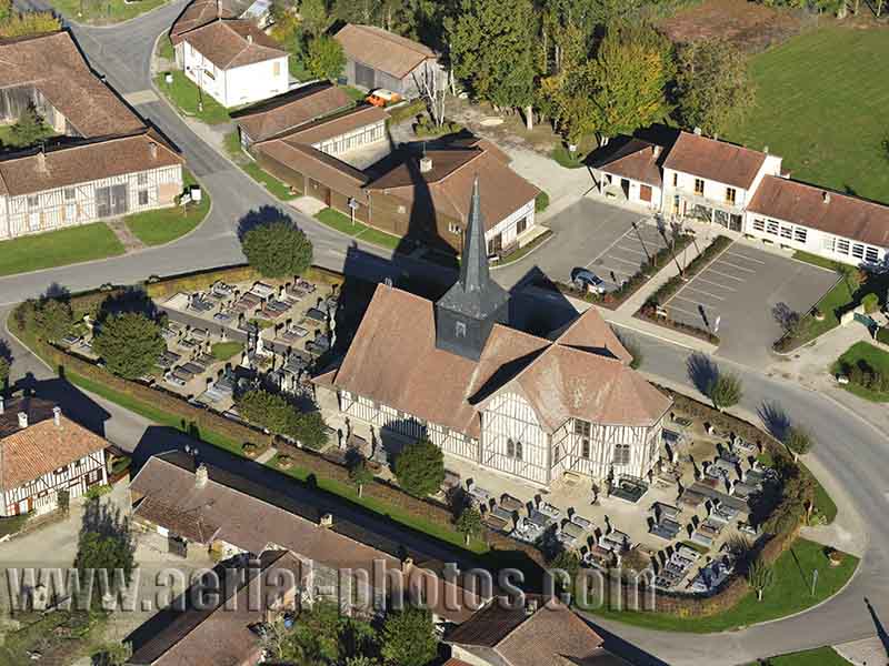
Outines is a small rural village on the southern shores of Lake of the Der. This unassuming village, nonetheless, is noteworthy for its remarkable and well-preserved traditional architecture. Wattle and daub was the way for the construction of buildings in a region where stones were lacking. Noteworthy, is the half-timbered Church of Saint-Nicolas. Built in the sixteenth century, the church was listed in the national register of historic monuments in 1964. Outines, Marne, Grand Est, France.
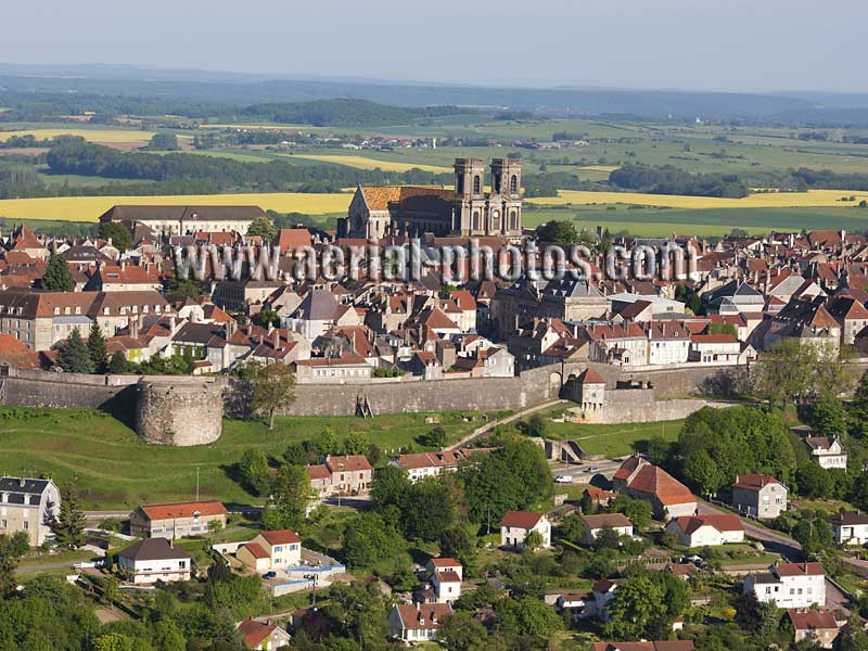
Langres is a town steeped in history that dates back to neolithic time. The town was strategically built on a limestone plateau making it easier to defend and offering extensive views of the surrounding landscape, it was also at a crossroad of historic trails. The town is entirely encircled by 3.5 kilometers of medieval defensive walls. Saint-Mammès Cathedral is a Roman Catholic church erected in the late twelfth century. On the Langres Plateau, three watersheds meet, their waters flowing towards, either the North Sea, the English Channel or the Mediterranean. Haute-Marne, Grand Est, France.


