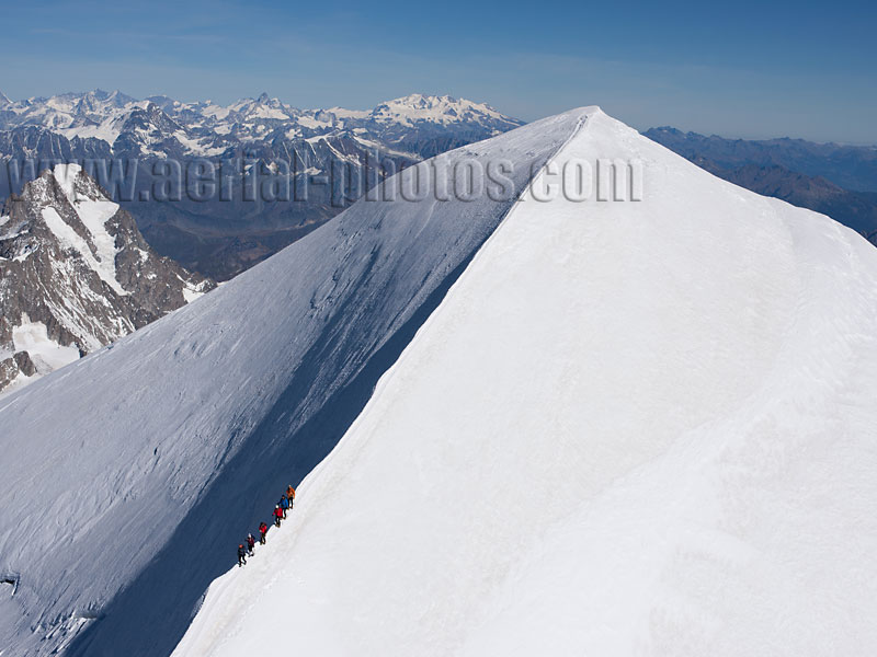
Mont-Blanc is the highest peak in the Alps and in Western Europe. Its elevation is around 4807 to 4810 meters depending on the snowpack and snowdrift. It was first climbed in 1786 by Jacques Balmat and Michel Paccard. A touchy issue between France and Italy is the exact location of the border. Between the two countries, the ridgeline (which is a line formed along the highest points of a mountain ridge) of the Mont-Blanc massif separates the two countries but the Mont-Blanc summit is included entirely in France on French maps. Chamonix, Haute-Savoie, Auvergne-Rhône-Alpes, France and Courmayeur, Aosta Valley, Italy.
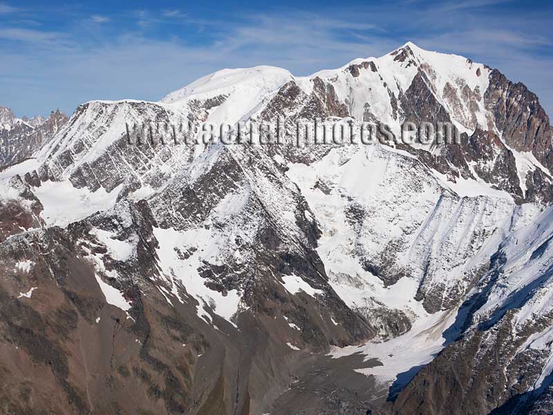
Southwestern rocky side of the Mont-Blanc Massif with (left to right) Aiguille du Goûter (3863m), Dôme du Goûter (4304m), and Mont-Blanc (4810m). Saint-Gervais-les-Bains, Haute-Savoie, Auvergne-Rhône-Alpes, France.
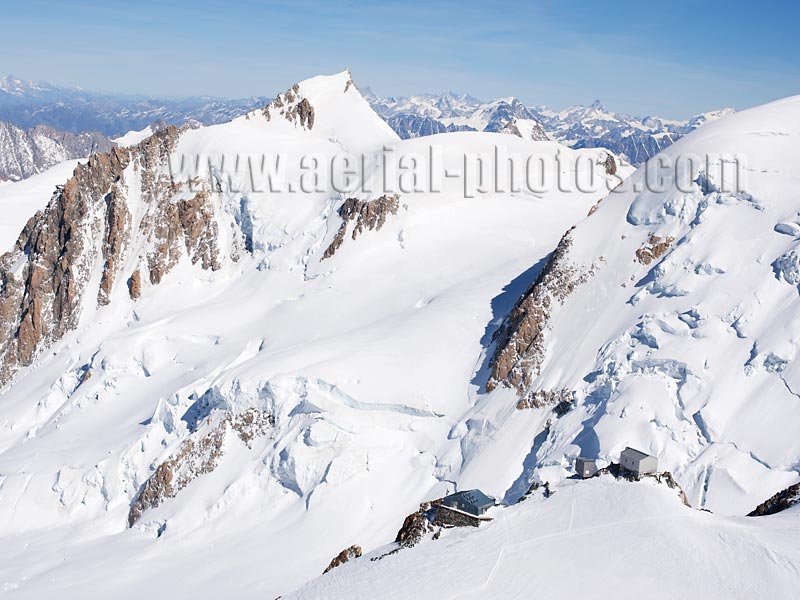
Mont Maudit (elevation: 4465m), in the lower right the two buildings are the historic Vallot Observatory (4350m), it is a research center and the Vallot Hut (4362m), it is an emergency shelter for mountaineers on the way to the summit of Mont-Blanc. Chamonix, Haute-Savoie, Auvergne-Rhône-Alpes, France.
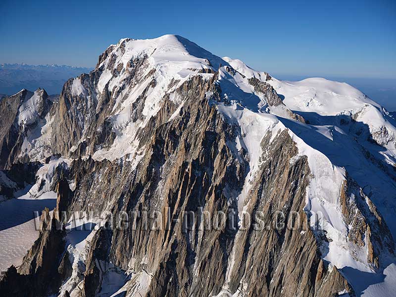
Mont-Blanc du Tacul (4248m) in the foreground with, in the distance, Mont-Blanc (tallest at 4810m) and to its right, Dôme du Goûter (4304m). Chamonix, Haute-Savoie, Auvergne-Rhône-Alpes, France.
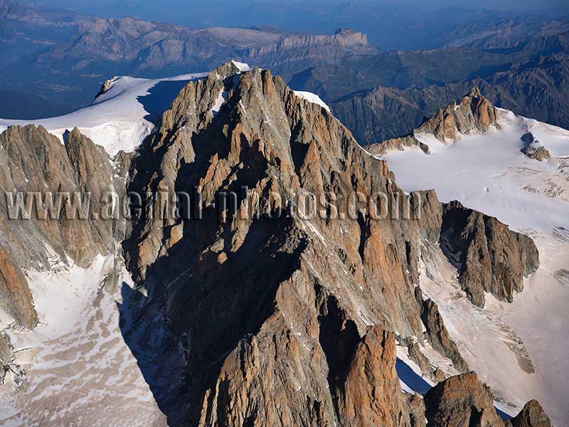
Mont Blanc du Tacul (4248m) viewed from the southeast. The southeast ridge slightly below the summit is dotted with many granitic pinnacles, they are called the Aiguilles du Diable (Devil’s needles). The Aiguille du Midi (3842m) is in the distance on the right. Chamonix, Haute-Savoie, Auvergne-Rhône-Alpes, France.
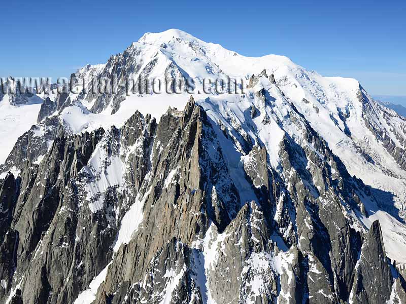
Les Aiguilles de Chamonix are a spectacular range of numerous jagged peaks stretching for over 5 kilometers, reaching heights up to 3842 meters at the Aiguille du Midi. Chamonix, Haute-Savoie, Auvergne-Rhône-Alpes, France.
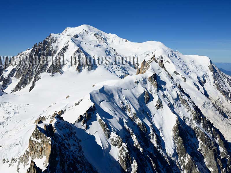
The Mont-Blanc massif is a wonderful playground for many thrill seakers; not just rock climbers but extreme skiers, speed riders, wingsuit flyers, paragliders, and so on. It is one of the most visited natural site in the world. Chamonix, Haute-Savoie, Auvergne-Rhône-Alpes, France.
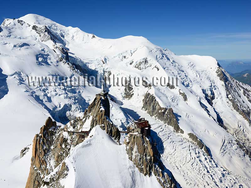
Summit of Aiguille du Midi (3842m) and its unrivaled, breathtaking view of Mont-Blanc (elevation: 4810m). Luckily, this amazing view does not require anyone to be an expert at rock climbing. A cable car can whisk 75 people in about 20 minutes from Chamonix (1035m) to the chilly thin rarefied air at nearly 4-kilometer-high. From such great heights, a viewer can contemplate the Bossons Glacier's toe a dizzying 2.4 kilometers below him. Chamonix, Haute-Savoie, Auvergne-Rhône-Alpes, France.
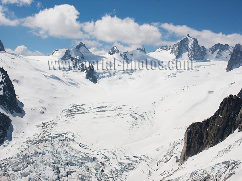
A little bit of Antartica in the heart of Europe. The Géant Glacier starts around Mont-Blanc du Tacul, its compacted snow feeds into the Mer de Glace making a combined length of 12km, it is the longest glacier in France. Chamonix, Haute-Savoie, Auvergne-Rhône-Alpes, France.
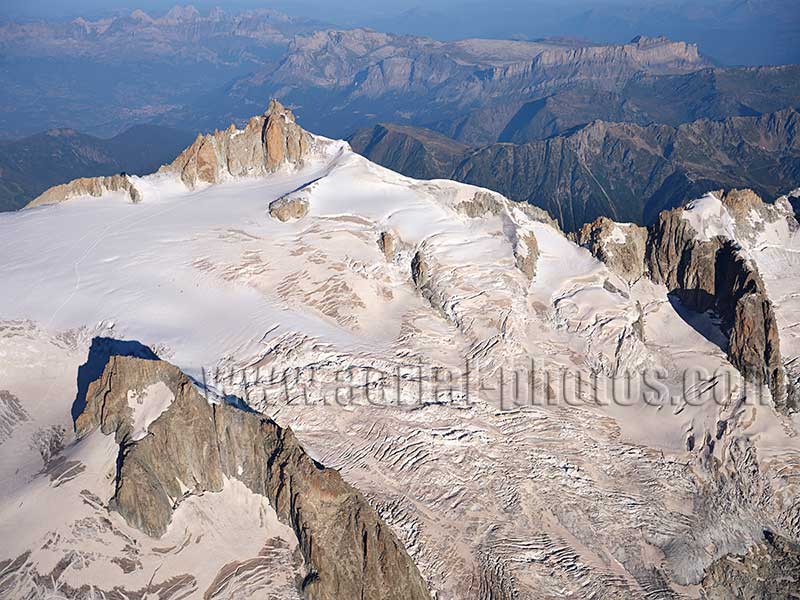
The Aiguille du Midi overlooking the famed Vallée Blanche to the east. This incredible view has been easily accessible from Chamonix (1035m) by means of an aerial cable-car as early as 1955. In 1957, a new aerial cable-car was built to "fly" above the Vallée Blanche from Aiguille du Midi to Gros Rognon (the rocky islet in the lower left) with a second section from Gros Rognon to Pointe Helbronner (3462m) in Italy. Chamonix, Haute-Savoie, Auvergne-Rhône-Alpes, France.
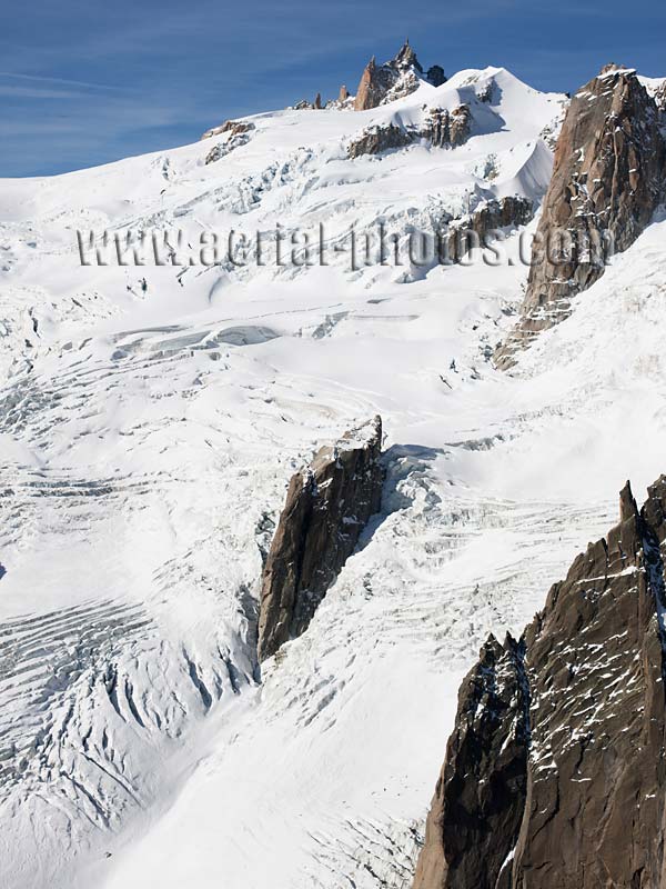
The Aiguille du Midi (elevation: 3842m) with, on its east facing slope, the famed Vallée Blanche. In the winter months, Vallée Blanche offers one of most attractive backcountry skiing in a grandiose landscape. From the Aiguille du Midi, skiers can reach Montenvers (elevation: 1930m) or even Chamonix (elevation: 1035m) depending on the snowpack, in one of the most spectacular scenery in the entire Alps. This ski run is on a glacier which is not groomed or patrolled, it is not technically difficult but dangerous because of hidden crevasses. Chamonix, Haute-Savoie, Auvergne-Rhône-Alpes, France.
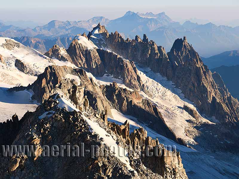
The spectacular scenery of the Mont Blanc Massif makes it one of the most visited natural site in the world. In this jagged point of view, there are, front to back, La Tour Ronde, Gros Rognon and Aiguilles de Chamonix. Chamonix, Haute-Savoie, Auvergne-Rhône-Alpes, France.
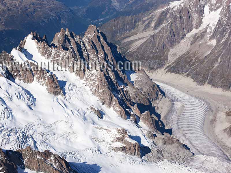
The southeast facing cliffs of the Aiguilles (needles) de Chamonix are called l'Envers des Aiguilles, there are a famous spot for rock climbers. They dominate the Vallée Blanche and the Mer de Glace with its distinctive Forbes Bands. Chamonix, Haute-Savoie, Auvergne-Rhône-Alpes, France.
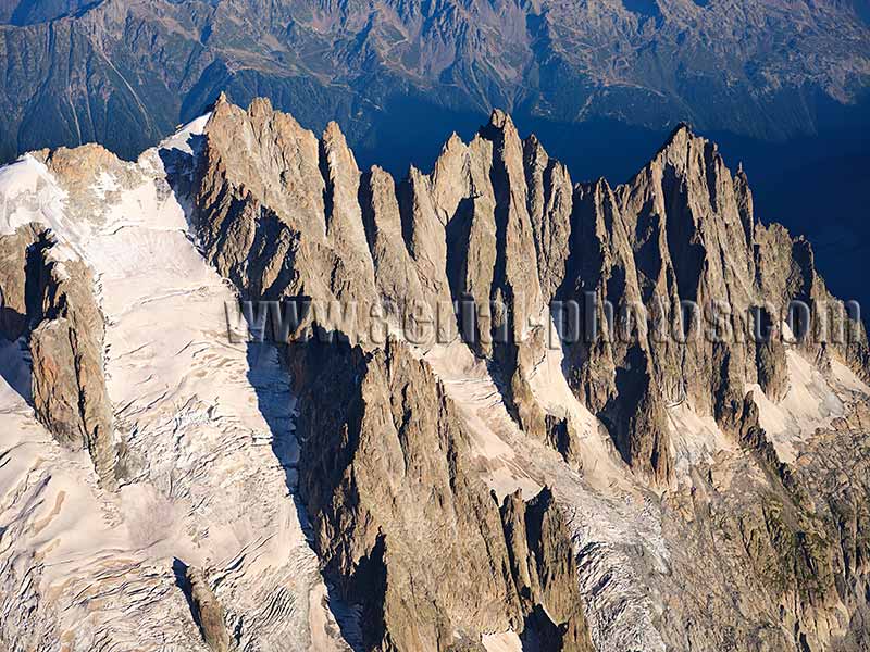
Envers du Plan Glacier with the Aiguilles de Chamonix (with left to right): Aiguille du Plan (3673m), Aiguille de Blaitière (3522m) and Aiguille du Grépon (3482m). Chamonix, Haute-Savoie, Auvergne-Rhône-Alpes, France.
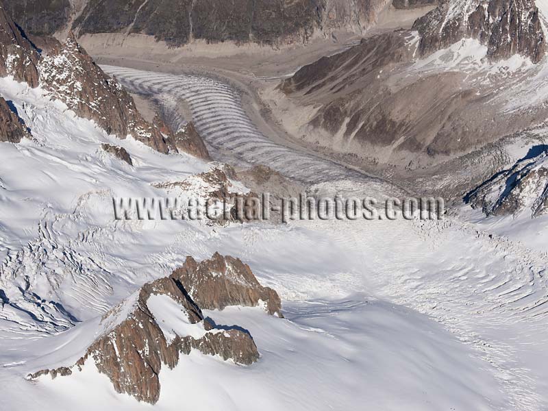
A Valley Glacier with the Géant Glacier (lower right) merging with the Vallée Blanche (lower left) feeding into the Tacul Glacier and finally the Mer de Glace (with Forbes Bands). Chamonix, Haute-Savoie, Auvergne-Rhône-Alpes, France.
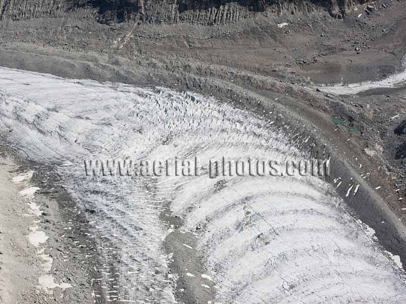
Forbes Bands (or ogive) are seasonal stripes, they are good indicators of the glacier's yearly speed; between 90 and 120 meters, slowing down at a lower altitude. Mer de Glace, Chamonix, Haute-Savoie, Auvergne-Rhône-Alpes, France.
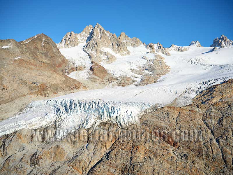
Glacier du Tour with Aiguille du tour (elevation: 3542 meters) in the distance. The Albert I refuge is located slightly above the glacier’s toe at an altitude of 2702 meters. The mountain hut is named after King Albert I of Belgium, who was a passionate alpinist. Chamonix-Mont-Blanc, Haute-Savoie, Auvergne-Rhône-Alpes, France.
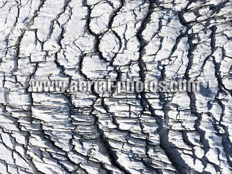
Interesting pattern of crevasses on the surface of the Bossons Glacier; they are due to the sharp change of angle of the underlying rock, bending and breaking the ice. The Bossons Glacier has the most vertical drop in the Alps. It starts from the summit of Mont-Blanc (elevation: 4810m) and ends at approximately 1400m (in 2011). It is currently retreating due to global warming, whereas in the 1900's, it reached the bottom of the Chamonix Valley (1050m). It is remarkable for a glacier to reach such a low altitude in relation to its latitude: 45º 53' 26" N. Chamonix, Haute-Savoie, Auvergne-Rhône-Alpes, France.
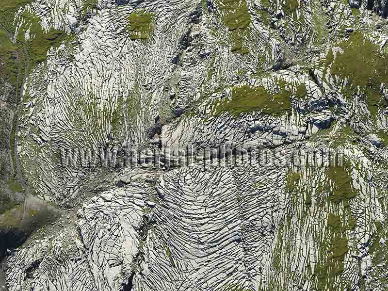
Not far from the Bossons Glacier, and strikingly resembling a glacier, there is an interesting rock formation called Désert de Platé. It is a limestone pavement: limestone is a slowly dissolvable rock in acid rain and with time can produce some interesting landforms. Sixt-Fer-à-Cheval, Haute-Savoie, Auvergne-Rhône-Alpes, France.


