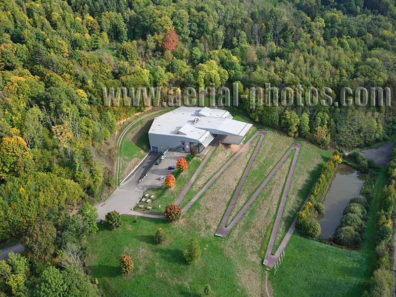
The Alsace Moselle Memorial is an interpretive center retracing the three wars that shook the region from the Franco-Prussian war in 1870 until the end of World War II in 1945. The memorial also features a detailed exhibit on the series of events in the aftermath of World War II that lead to the creation and strengthening of the European Union. The seat of the European Parliament (6 member countries when it was founded in 1952, 27 member countries in 2022) is in Strasbourg, about 50 kilometers from the memorial. Schirmeck, Bas-Rhin, Alsace, Grand Est, France.
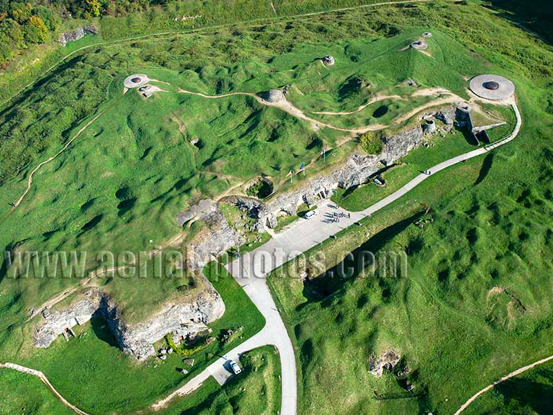
At the end of the Franco-Prussian War, in 1871, the new German border was near the city of Verdun. This prompted the French government to build a belt of forts surrounding the city. 19 were built, Fort Douaumont was the largest and the highest. During WWI, the Fort was captured on February 25, 1916 by German troops. What followed was 8 months of hell for both opposing armies as the French tried to recapture this strategic fort. It was French again on October 24, 1916. Fort Douaumont still bears traces of shell craters more than 100 years after the end of the conflict. Massive 420mm German howitzer and the corresponding 400mm French howitzer had been used on the front line. Douaumont-Vaux, Meuse, Grand Est, France.
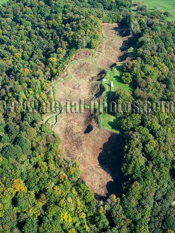
The Western Front of World War I stretched for over 650 kilometers across Belgium and France. On just a short 500-meter-long stretch, at the Vauquois Butte, 14,000 soldiers died between 1915 and 1918. The tactic used here was mine warfare by tunneling under the enemy’s line and laying tens of tons of explosives. Vauquois, Meuse, Lorraine, Grand Est, France.
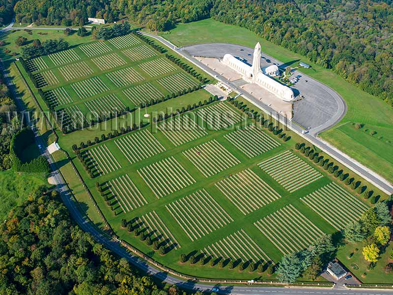
The National Necropolis of Douaumont contains the graves of 16,142 French soldiers who died in the Battle of Verdun. In 1916, the most dreadful year of the conflict, under a continuous shelling, more than 300,000 soldiers died within a few kilometers from this cemetery. Fleury-devant-Douaumont, Meuse, Lorraine, Grand Est, France.
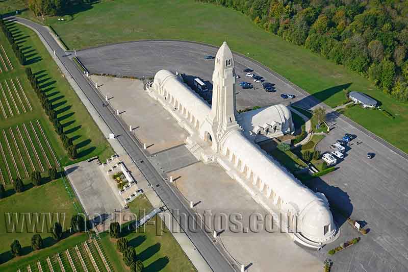
The Douaumont Ossuary is a World War One memorial containing the skeletal remains of 130,000 unknown soldiers, French and German. The 46-meter-high tower is accessible to visitors. From this vantage point, they can observe the vast cemetery and ponder over the senselessness of wars. Fleury-devant-Douaumont, Meuse, Lorraine, Grand Est, France.
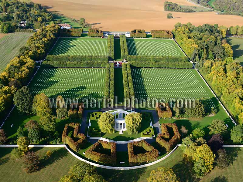
The St. Mihiel American Cemetery is a resting place for 4,153 soldiers who died in the offensive that resulted in the reduction of the St. Mihiel salient during World War I. In the foreground, the white colonnade is a memorial. It consists of a small chapel, a granite funerary urn, two marble plaques on which are inscribed the 284 gilded names of the missing, and a large map of multi-colored marbles depicting the St. Mihiel's offensive. Thiaucourt-Regniéville, Meurthe-et-Moselle, Grand Est, France.
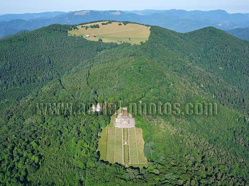
The Hartmannswillerkopf National Monument is a Memorial and a National Necropolis of the First World War. It is one of four WWI National Monuments, three of which are in the Grand Est Region. The Memorial is located below the Hartmannswillerkopf Peak also known as the “Vieil Armand” (elevation: 957 meters) on the Vosges Mountains. Fierce fighting took place here in 1915 as this coveted site had a clear view of the Rhine Valley some 700 meters below. An estimated 7,000 French and German soldiers died on this battlefield. Wattwiller, Haut-Rhin, Alsace, Grand Est, France.
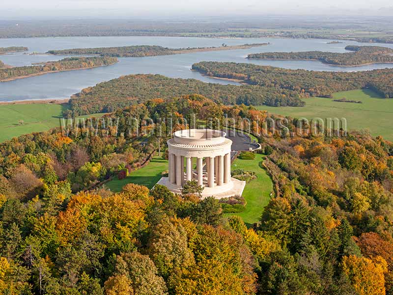
The Montsec American Monument is a memorial to honor the American soldiers who fought in the region towards the end of World War I. It is built on an isolated butte at an elevation of 377 meters, Lake Madine (elevation 240 meters) can be seen in the distance. This strategic viewpoint over the surrounding terrain was already exploited by the Gauls and Romans. Most German salients on the Western Front were cleared by Allied counteroffensives in the middle of 1918. But the St. Mihiel Salient was still there. Its elimination was crucial. The St. Mihiel Salient was eliminated on September 16, 1918 by American and French troops. During World War II, the butte was seized again by the German Army. Montsec, Meuse, Lorraine, Grand Est, France.
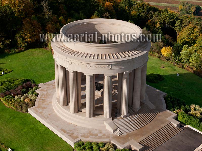
The Memorial was built in 1932 by the American Battle Monuments Commission; an agency whose mission is to honor the U.S. Armed Forces. This agency administers 26 American military cemeteries and 32 memorials in 17 foreign countries. These sites outside the U.S. are not American territory but are granted in perpetuity, free of any taxes or any other charges. The circular colonnade is built with white limestone from a local quarry. In its center, a large bronze relief map illustrates the military operations that took place in the St. Mihiel salient. The memorial was classified as a historic monument in 1975. Montsec, Meuse, Lorraine, Grand Est, France.
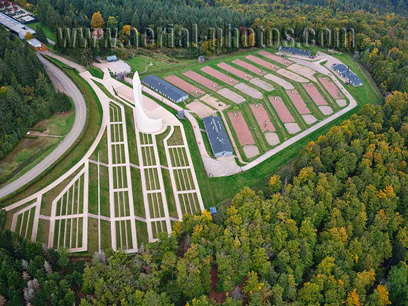
The Struthof is a concentration camp from World War II. Himmler, Head of the SS, ordered the construction of this camp near the village of Natzwiller because of the presence of a vein of granite that could be exploited for the Nazi’s projects. This concentration camp is the only one on French territory—at the time, Alsace and Moselle had been annexed by the Third Reich. Natzwiller, Bas-Rhin, Alsace, Grand Est, France.
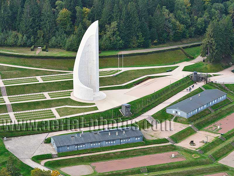
A 40-meter-high memorial was built for all of those who perished in the camp, were reduced to ashes in the crematorium and deprived of a proper burial site. The memorial was inaugurated in 1960 by Charles de Gaulle, French president from 1959 to 1969. To the left of the memorial, a National Necropolis contains the graves of 1,116 French people and foreigners who died after their arrival in the camp. Natzwiller, Bas-Rhin, Alsace, Grand Est, France.
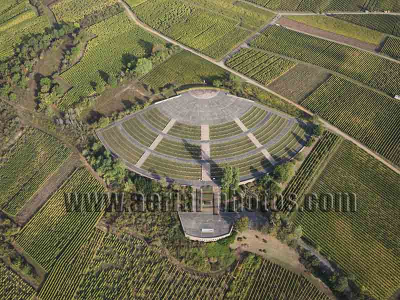
The National Necropolis of Sigolsheim is a French military cemetery of the Second World War. It is located on a hill named Blutberg (German for Mountain of Blood) where the deadliest fighting took place between December 1944 and February 1945. Of the 1589 soldiers buried in the necropolis, 792 are North Africans and 15 are jews. The 1st Army, which liberated southern Alsace, was formed in North Africa and was part of the landing operation of Provence (Operation Platoon) on August 15, 1944. Sigolsheim, Kaysersberg Vignoble, Haut-Rhin, Alsace, Grand Est, France.
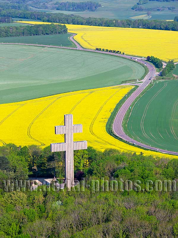
The Cross of Lorraine is the symbol of the Free French Forces during World War II. After the death of General De Gaulle on November 9, 1970, a national committee placed under the high patronage of Georges Pompidou, president of the French Republic, was formed on March 23, 1971 to erect a monument in Colombey-les-deux-Églises. The committee launched a national subscription collecting several million Francs in donations from France and 67 foreign countries. The monument was inaugurated by Georges Pompidou on June 18, 1972. Colombey-les-deux-Églises, Haute-Marne, Grand Est, France.
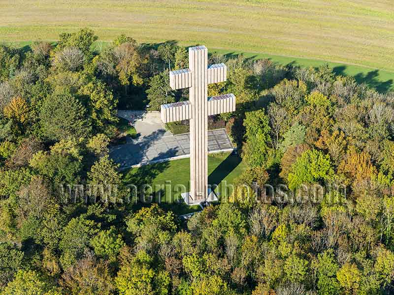
The monumental Cross of Lorraine is a 44.30-meter-high structure weighing 950 tons. The two arms measure, respectively, 14.12 and 19.16 meters. The structure is made of concrete and covered with 1,638 layers of pink granite from the Brittany Region and vertical bands of bronze from an Alsatian foundry. It stands on a hilltop near the small town of Colombey-les-deux-Églises where Charles de Gaulle had settled. Haute-Marne, Grand Est, France.
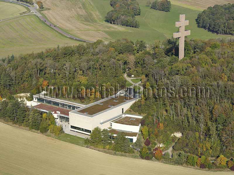
At the foothill of the Cross of Lorraine stands the Charles de Gaulle Memorial. It was officially launched in 2006 by french president Jacques Chirac. In 2008 (or 50 years after the historic meeting De Gaulle / Adenauer), the Memorial was inaugurated by the newly elected french president Nicolas Sarkozy and the german chancellor Angela Merkel. The memorial is an interpretation center about the life of Charles de Gaulle (1890-1970) and the major historical events that shaped the twentieth century. Colombey-les-deux-Églises, Haute-Marne, Grand Est, France.
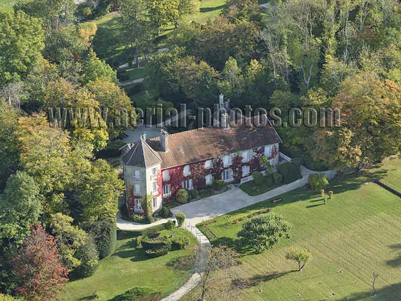
Born in Lille, in the Hauts-de-France Region, Charles de Gaulle acquired this home nicknamed “La Boisserie” in the tranquil countryside near Colombey-les-deux-Églises in eastern France. He bought it in 1934 as a life annuity and was able to move in only two years later. In this peaceful retreat he could recharge once in a while from his tumultuous political life, but also, he made some important decisions there. In 1958, he invited the german chancellor Konrad Adenauer; it was an important step towards the Franco-German reconciliation and the European construction. Haute-Marne, Grand Est, France.
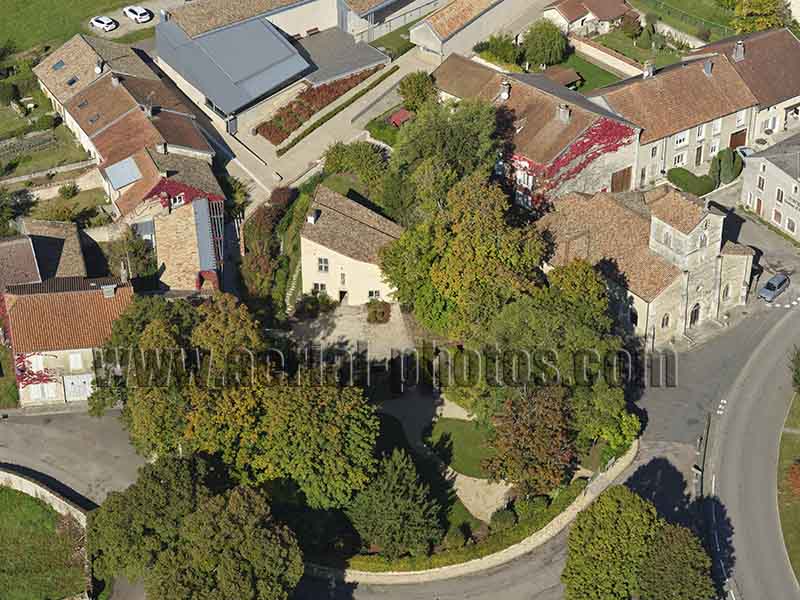
The small village of Domrémy-la-Pucelle is the birthplace of Joan of Arc, she was born circa 1412 in the home with the one-sided roof. To the right of her home is the Saint-Rémy Church, Joan of Arc was baptized there. Behind her home, the modern building is an interpretation center on the life of the heroine. When her home was designated as a Historic Monument in 1840, it was the first building to get this protection in France. Domrémy-la-Pucelle, Vosges, Grand Est, France.
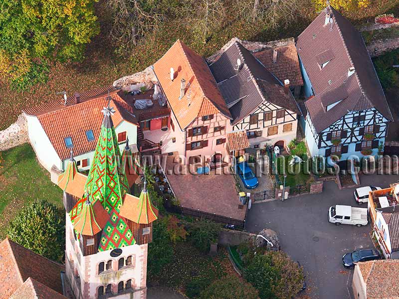
Châtenois is a picturesque stopover on the Alsace Wine Route. This is a medieval village surrounded by two enclosures dating from the 13th and 15th centuries respectively. Noteworthy is St. George’s Church. It is a Catholic parish church dating back to the 18th century with an older (1540) Romanesque steeple with four watchtowers made of chestnut wood. The interior of the church, which features a Silbermann pipe organ from 1765, a processional crucifix from 1763 encrusted with mother-of-pearl, and four 16th-century polychromic wooden reliefs, is also remarkable. Châtenois, Bas-Rhin, Alsace, Grand Est, France.
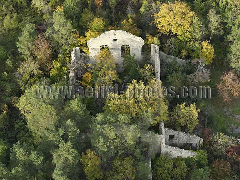
Abandoned building overgrown with vegetation. Ville-sous-la-Ferté, Aube, Grand Est, France.
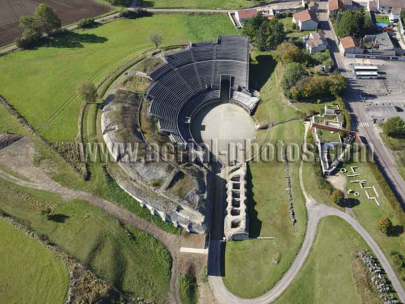
In this sparsely populated countryside of the Vosges Region, in the village of Grand, stands one of the largest amphitheater of the Roman world with a seating capacity of 17,000 spectators. This amphitheater dates back to the end of the 1st century A.D. Recently, bleachers were added for contemporary shows. Grand, Vosges, Grand Est, France.


