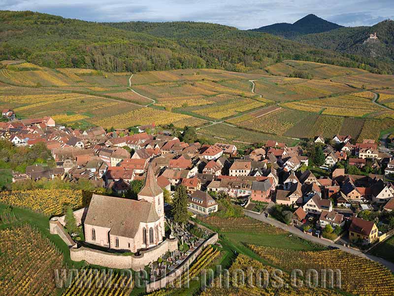
Located at the foothills of the eastern Vosges Mountains in a landscape of vineyards, the village of Hunawihr is one of the five Alsatian villages labeled “one of the most beautiful villages of France.” The village is dominated by the Church of Saint-Jacques-le-Majeur. The church built in the 15th century is classified as a historic monument. In the distance, Saint-Ulrich Castle can be seen. Hunawihr, Haut-Rhin, Alsace, Grand Est, France.
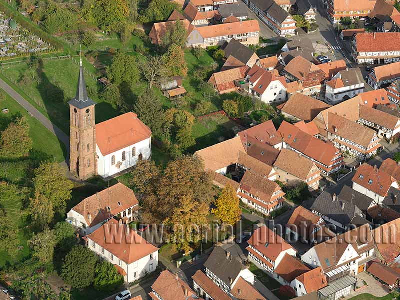
Every year, since 2012, the TV show named “France’s favorite village” offers television viewers the possibility to vote for their favorite village. Although Alsace is less than 1/66th the size of France, it has won the title four times with the picturesque villages of Eguisheim in 2013, Kaysersberg in 2017, Hunspach in 2020 (photo above) and Bergheim in 2022. Hunspach, Bas-Rhin, Alsace, Grand Est, France.
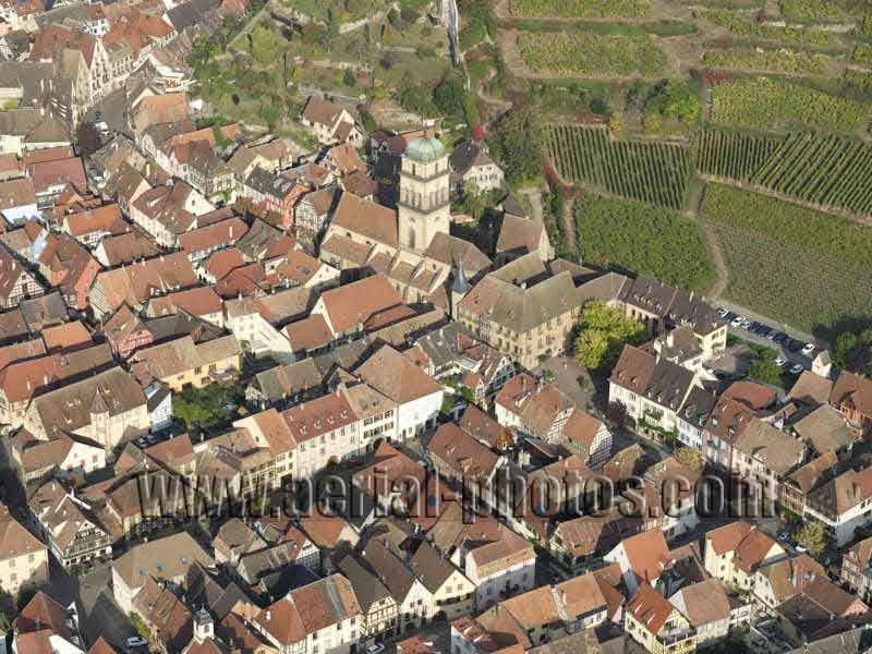
Kaysersberg is a medieval town dating back to the early thirteenth century. It was built to control the fairly easy access to the Lorraine Region via the Vosges Mountains. Sainte-Croix Church is from the 13th century with different architectural elements added the following centuries; the steeple was rebuilt in 1825 with a rounded shape to allow the installation of a carillon of 5 bells. The town is a touristic stopover on the picturesque Alsace Wine Route and was elected “France’s favorite village” in 2017. Kaysersberg Vignoble, Alsace, Grand Est, France.
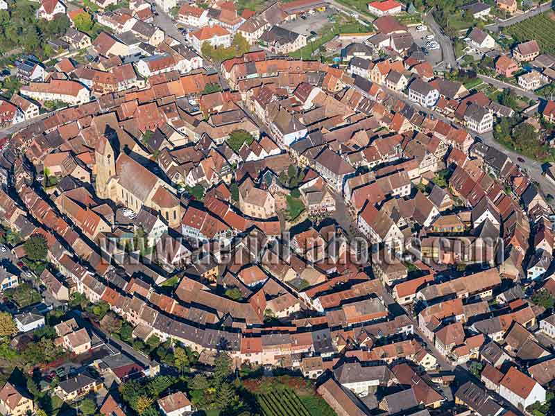
Eguisheim is a picturesque Alsatian village with colorful half-timbered facades along the cobblestone streets. This medieval town built around a castle unfolds in concentric circles. It has the label “one of the most beautiful village of France” and won the title “France’s favorite village” in 2013 on a TV show. Haut-Rhin, Alsace, Grand Est, France.
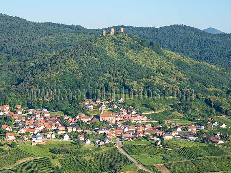
Most castles in the Alsace region are on the eastern Vosges Mountains, they overlook the Plain of Alsace to the east. Here the Three Castles of Eguisheim dominate the village of Husseren-les-Châteaux. This is a typical village on the 170-kilometer-long Alsace Wine Route, and like all the other villages on this itinerary, the Vosges Mountains are always present for scenic backdrop. Haut-Rhin, Alsace, Grand Est, France.
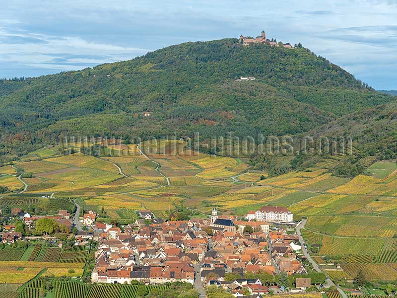
The town of Saint-Hippolyte is a picturesque fortified medieval town with ramparts built in 1316 when the area was an enclave of Lorraine within Alsace. The town, on the scenic wine route, is well-known for its “Pinot Noir” wine; this is the only red wine from Alsace, a region known for its white wine. The town is dominated by the Haut-Koenisgbourg Castle. Saint-Hippolyte, Haut-Rhin, Alsace, Grand Est, France.
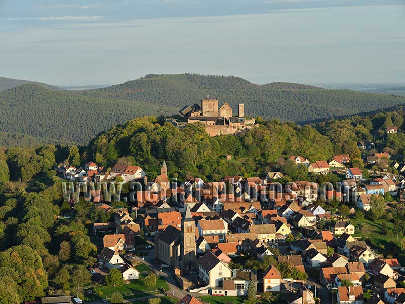
The old village of Lichtenberg is located in the sparsely populated region of the northern Vosges Mountains. The town is within the boundary of the Northern Vosges Regional Nature Park which covers an area of 1276km2 of mountainous woodland and historic sites. The park is listed as a UNESCO Biosphere Reserve. The village is dominated by its castle whose both histories can be traced back as early as the 13th century. Lichtenberg, Bas-Rhin, Alsace, Grand Est, France.
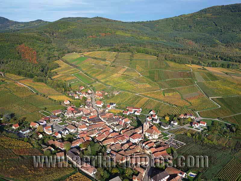
Rodern is a charming wine-growing village between the Vosges’ foothills and the Alsace Wine Route. The village is famed for its Pinot Noir and Grand Cru Gloeckelberg. The Church of St-Georges, built on a small mound overlooking the village, is from the mid-18th century. The ground floor of its steeple is from a previous church built circa 1310. Rodern, Haut-Rhin, Alsace, Grand Est, France.
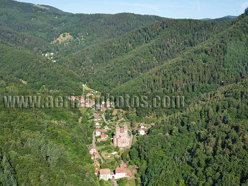
Murbach is a small village nestled in a picturesque valley at the foothills of the Grand Ballon, Vosges’ highest summit. This is a quiet and quaint village not so far from the hustle and bustle of the Alsace Plain, but it has not always been so as it is home to the renowned Abbey of Murbach which was very influential over a large region for at least one millennium beginning in 728 CE when it was founded. Haut-Rhin, Alsace, Grand Est, France.
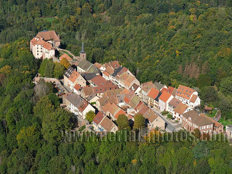
La Petite Pierre is a medieval village located in the wilderness of the northern Vosges Mountains. The site has been occupied since Celtic times, and a town developed there. The castle at the end of the promontory was built in the late 12th century, and brings elements dating from the 13th to the 18th century. A drawbridge separated the castle from the village. The town’s economy is based on tourism, and the Northern Vosges Regional Nature Park has its headquarters there. La Petite Pierre, Bas-Rhin, Alsace, Grand Est, France.
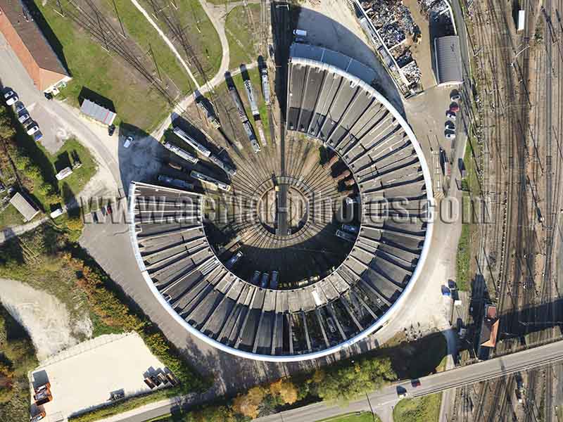
The Rotonde is a roundhouse where locomotives are stationed for maintenance and repair. The Rotonde can accommodate up to 50 locomotives which are brought through a turntable, 27 meters in diameter. It is located on the historic railway station of Chalindrey which was founded in 1858 and is roughly midway between Paris and Basel in Switzerland. Haute-Marne, Grand Est, France.
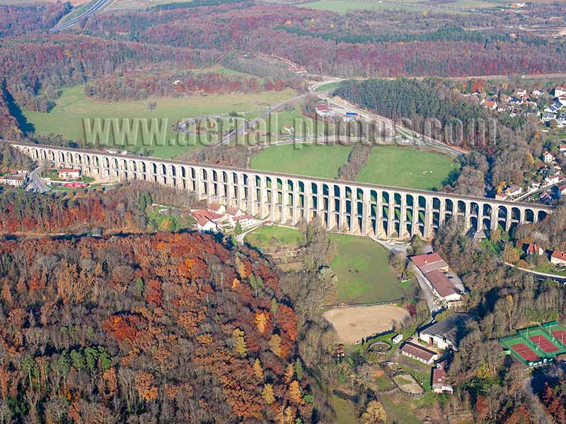
Remarkable architectural work, the Viaduct of Chaumont, inaugurated in 1856, allows the railroad connection between Paris and Basel in Switzerland. This three-story semi-circular arch viaduct has some respectable dimensions for a structure built in the mid-nineteenth century with a length of 600 meters and a height of 52 meters above the Suize River. Haute-Marne, Grand Est, France.
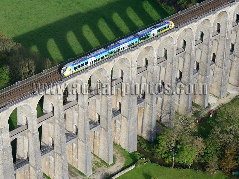
The Viaduct of Chaumont has been in continuous use since 1856, with the exception of the year 1944 when four piers had been dynamited by German troops. Here the colorful regional express train is painted with the symbolic colors of the former Champagne-Ardenne region, now absorbed into the larger Grand Est region. Haute-Marne, Grand Est, France.
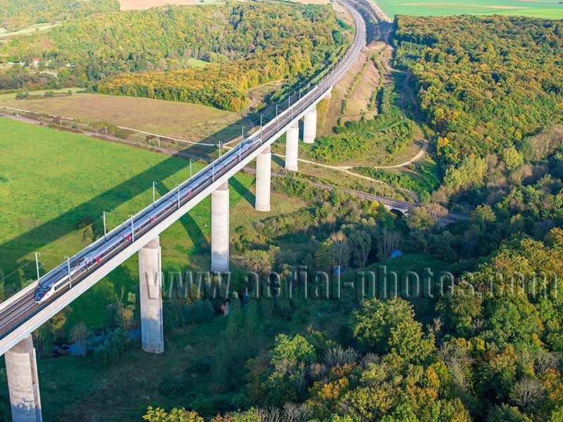
The “Train à Grande Vitesse” (TGV) is a high-speed train that has a cruising speed of 320 km/h. Here, the westbound TGV zips past the Rupt Valley. The viaduct, completed in 2006, is 480-meter-long and 50-meter-high. In 2007, high-speed tests were conducted on this line and a modified train reached a mind-boggling speed of 574 km/h. The “Ligne à Grande Vitesse Est européenne” (LGV Est) is a high-speed line linking Paris to Strasbourg (406 kilometers traveled in only 1h45mn). Thiaucourt, Meurthe-et-Moselle, Grand Est, France.
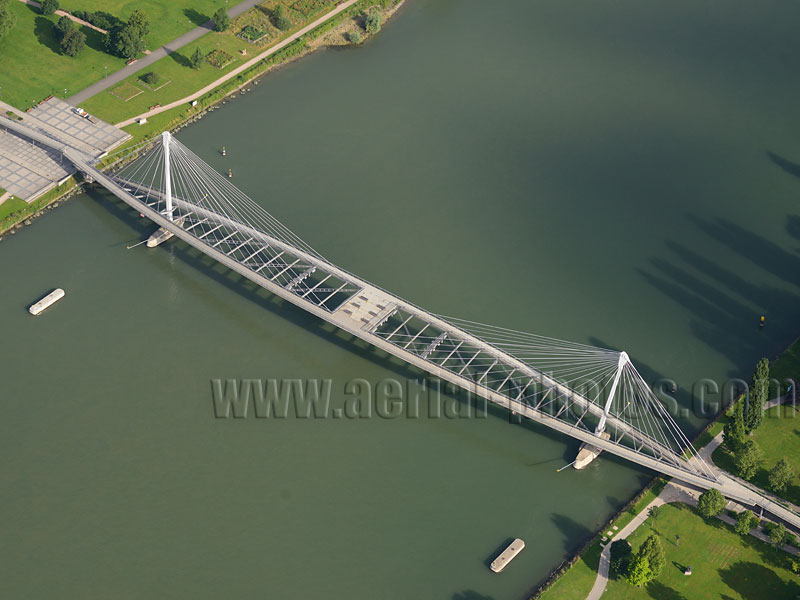
The Jardin des Deux Rives (Garden of the Two Banks) is a cross-border public park between the city of Strasbourg in France and the city of Kehl in Germany. Separated by the Rhine River, the two parts of the garden are connected by the Passerelle des Deux Rives (Footbridge of the Two Banks) also known as Passerelle Mimram (Mimram Footbridge) named after the architect Marc Mimram who designed it. Strasbourg, France and Kehl, Germany.
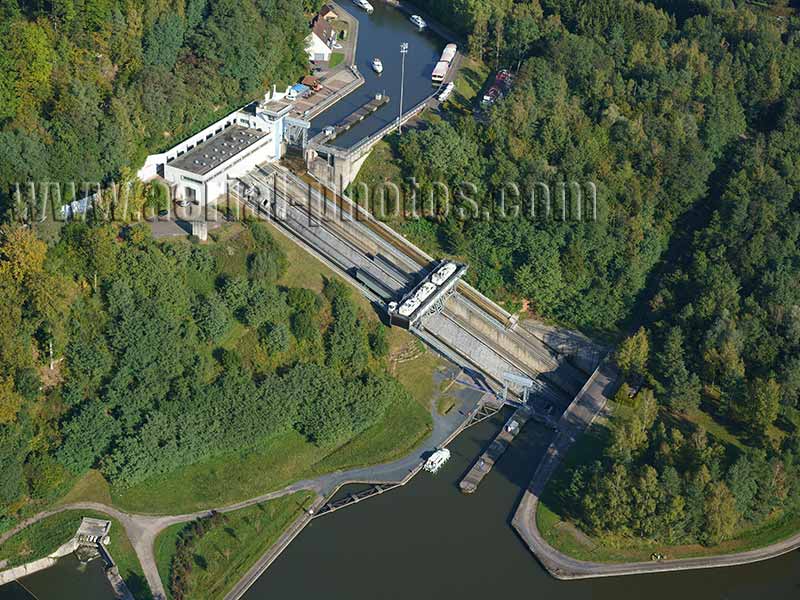
The historic Marne-Rhine Canal was opened in 1853, at a time when barges were not motorized yet but were hauled by horses or mules. It allowed to connect Paris (the Marne is an affluent of the Seine) with Alsace and Germany beyond. Crossing the steeper eastern Vosges Mountains involved going through 17 time-consuming locks. The inclined boat lift of Saint-Louis Arzviller was inaugurated in 1969, bypassing the 17 locks, thus reducing the travel time from an entire day down to around 20 minutes. Saint-Louis, Moselle, Grand Est, France.
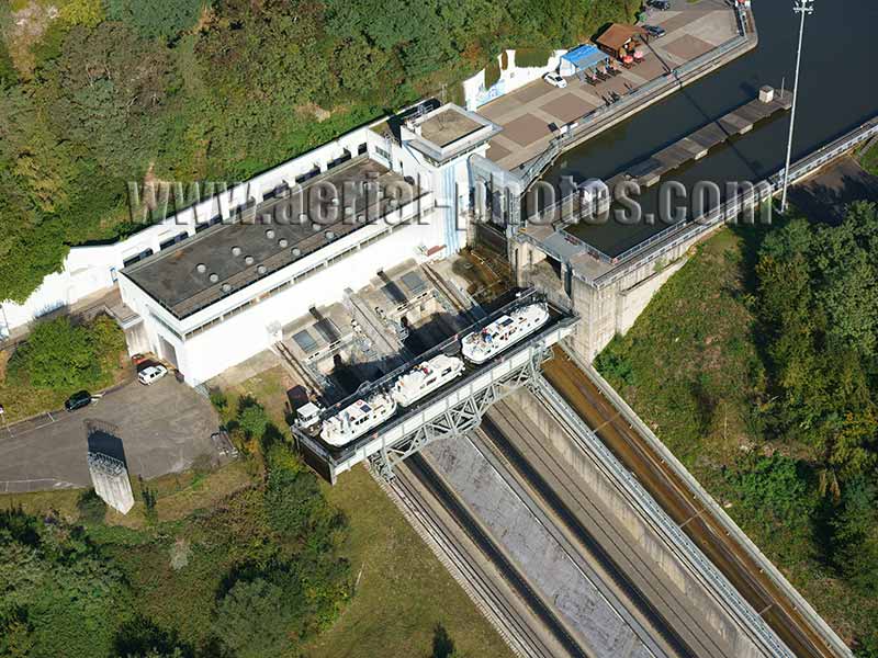
When the inclined boat lift opened in 1969, most of the traffic was commercial. In the 1980s, recreational boating took over and nowadays, around 8,000 pleasure boats pass through every year. The difference in elevation is 44.50 meters. Surprisingly, the boat lift’s engine uses very little power as there is a counterweight and that any boat entering the caisson will displace water equivalent to its mass to the canal. Also, the boat lift doesn’t waste any water unlike that wasted by the use of the previous 17 locks. Saint-Louis, Moselle, Grand Est, France.
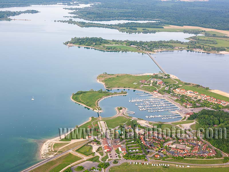
The Lake of the Der was built, primarily, to regulate the flow of the Marne River to prevent flooding to cities downstream. A nice side effect of this reservoir is its use for recreational activities. The Marina of Giffaumont is one of the three marinas on the lake. Marne / Haute-Marne, Grand Est, France.
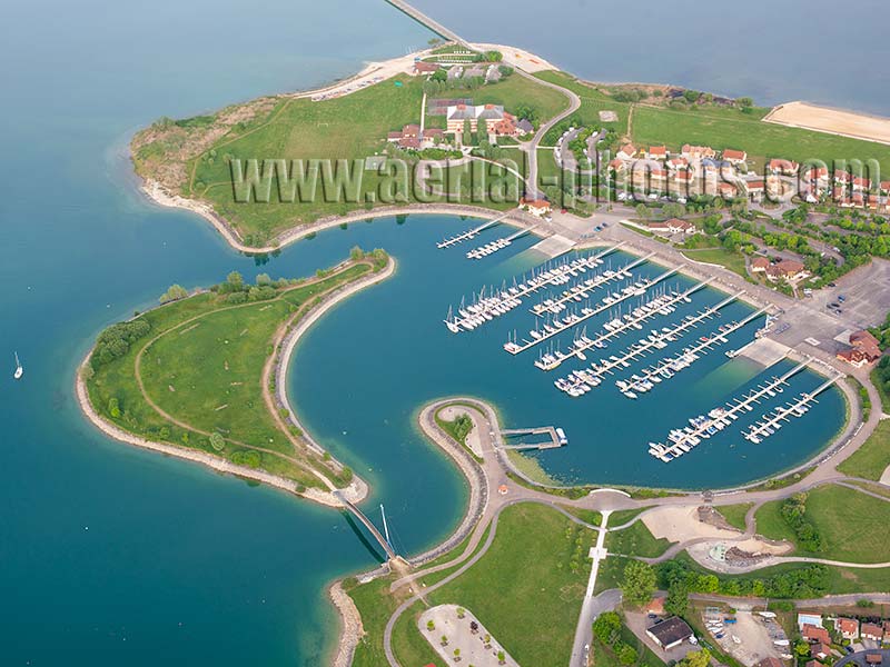
Tourism has taken the place of agriculture in the local economy of Giffaumont-Champaubert. Three agricultural villages were submerged by the lake and a new city entirely dedicated to leisure activities was born on the lakeside. The Giffaumont-Champaubert Marina can accommodate 400 berths, and there is a casino nearby. Marne / Haute-Marne, Grand Est, France.
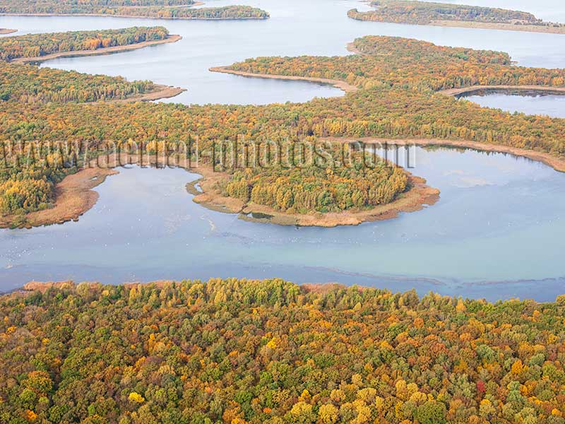
Lake Madine is an artificial reservoir on the Madine River which is an affluent of the Moselle. Filled with water in 1971, the lake which has a surface area of 11km2 and 42 kilometers of shoreline fulfills three purposes: a water storage facility for the the city of Metz, a wildlife refuge and a recreational area. Meuse, Grand Est, France.


