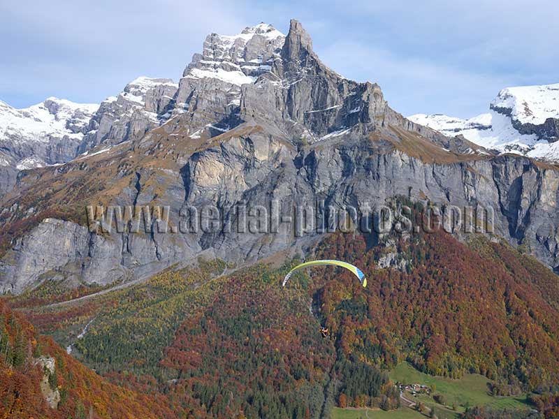
Paraglider soaring towards the vertiginous cliffs of the Cirque du Fer-à-Cheval. In the middle, the rocky peak without snow is the 2562-meter-high Cornes du Chamois. It dominates the landscape although behind it to the left, Pic de Tenneverge is taller with an elevation of 2989 meters. Sixt-Fer-à-Cheval, Haute-Savoie, Auvergne-Rhône-Alpes, France.
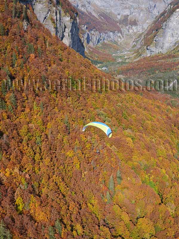
Paraglider soaring above a forest with its striking automnal colors in the Giffre Valley. Haute-Savoie, Auvergne-Rhône-Alpes, France.
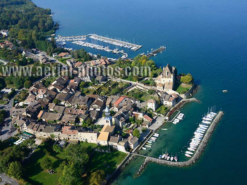
Medieval village of Yvoire on the left bank of Lake Geneva. Haute-Savoie, Auvergne-Rhône-Alpes, France.

Port Ripaille is a man-made marina in a wooded environment on the picturesque shore of Lake Geneva. All 550 apartments have a direct access to a mooring. Thonon-les-Bains, Haute-Savoie, Auvergne-Rhône-Alpes, France.

The Casino of Évian-les-Bains (the spa town with the famous mineral water) on the left bank of Lake Geneva. Haute-Savoie, Auvergne-Rhône-Alpes, France.
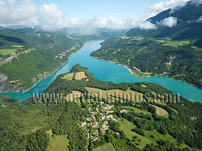
Hamlet of Villarnet overlooking Lake Monteynard. Isère, Auvergne-Rhône-Alpes, France.
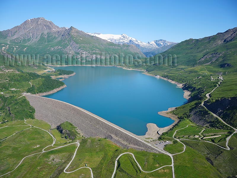
Lake Mont-Cenis is an alpine reservoir at an altitude of almost 2000 meters located near the Mont-Cenis Pass (elevation: 2083 meters). Although the lake’s drainage is on the Italian side of the mountain and flows into the Po Valley, the entire lake is within French territory. After World War II, the area was obtained by France via the 1947 Paris Treaty as war reparations. Val-Cenis, Savoie, Auvergne-Rhône-Alpes, France.
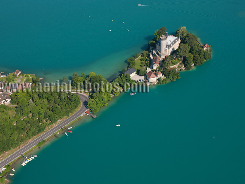
A medieval fortress has occupied this site for nearly a millennium, its architecture has changed over the centuries. The castle was built on an island turned into a peninsula; it was strategically located between Lake Annecy where it is the narrowest and the historic road connecting Geneva to Moûtiers. Château de Duingt, Haute-Savoie, Auvergne-Rhône-Alpes, France.
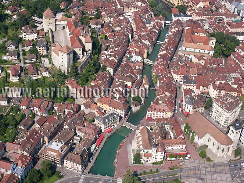
The old town of Annecy stands on the banks of the Thiou River, an outlet of Lake Annecy. The picturesque and colorful medieval houses dominated by the imposing castle make the old town a prime destination for foreign visitors. Haute-Savoie, Auvergne-Rhône-Alpes, France.
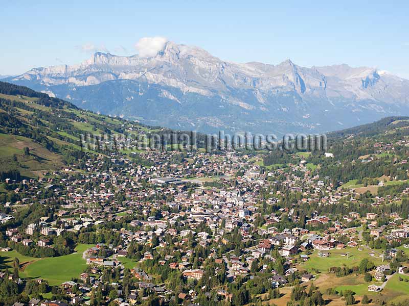
The upscale mountain resort of Megève (elevation: 1096m) looking north towards Tête du Colonney (elevation: 2692m). Haute-Savoie, Auvergne-Rhône-Alpes, France.
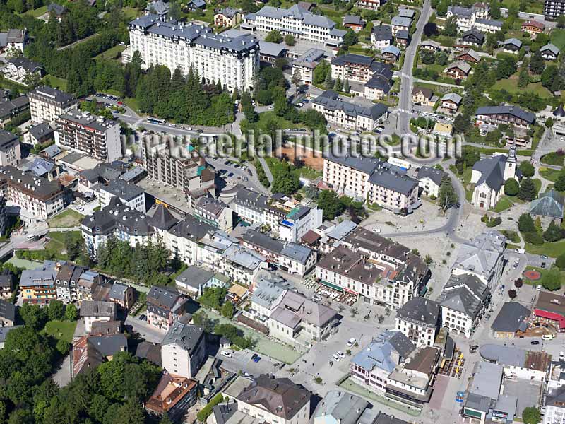
The center of Chamonix Mont-Blanc with the Arve River. Chamonix is a bustling city all year round, it is considered, and rightly so, the mountaineering capital of the world. A short five to ten-minute walk from the Church Square are the Aiguille du Midi cable car and the Montenvers cog train, both will take visitors, in less than half an hour, into another world made of granite and glaciers. Haute-Savoie, Auvergne-Rhône-Alpes, France.
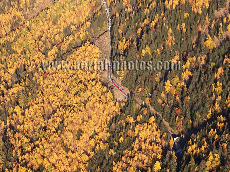
In operation since 1909, the historic Montenvers Cog Train has taken countless visitors to see the wonders of the Mer de Glace, the longest glacier in France. Before reaching its terminal station above timberline at an elevation of 1913 meters, the train climbs up through a forest of larches, turning a dazzling yellow in the fall. Chamonix Mont-Blanc, Haute-Savoie, Auvergne-Rhône-Alpes, France.
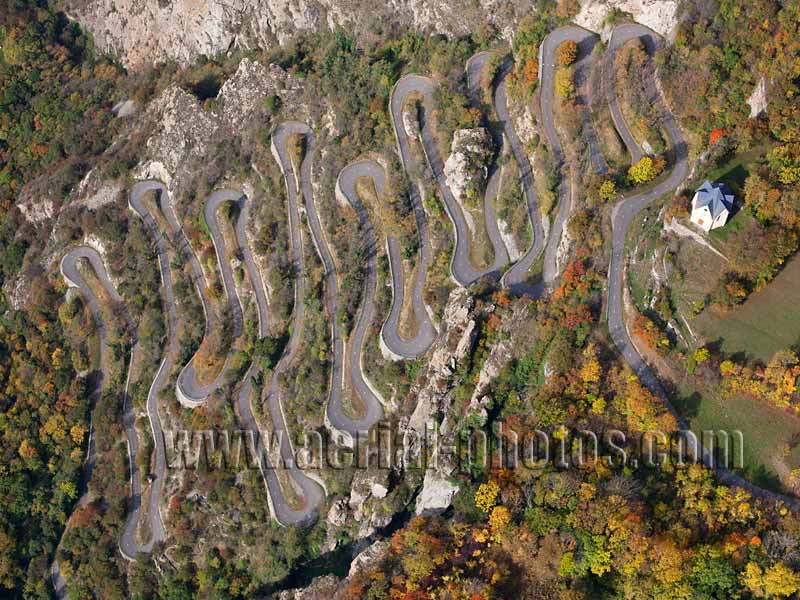
Opened in 1933, this scenic road was built to have access from the Arc Valley to the remote village of Montvernier, high on a clifftop. Being scenic and with a 400-meter-high climb through 18 switchbacks, it is a cyclist magnet, and sometimes the Tour de France tackle this challenging climb. Lacets de Montvernier. Savoie, Auvergne-Rhône-Alpes, France.
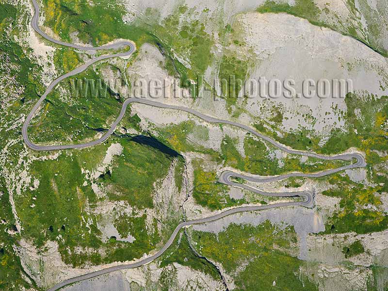
Picturesque winding road leading to the Galibier Pass from the city of Valloire. The Galibier Pass is on the itinerary of the “Route des Grandes Alpes.” The “Route des Grandes Alpes” is one of the most picturesque sightseeing roads in Europe, it crosses the entire French Alps from Lake Geneva to the French Riviera. Valloire, Savoie, Auvergne-Rhône-Alpes, France.
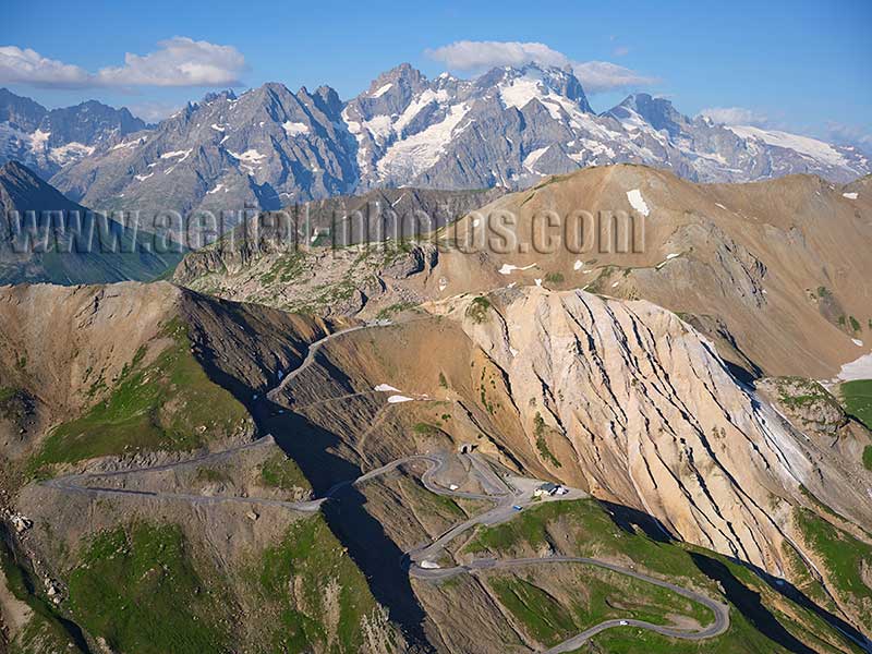
Col du Galibier (2642 meters) with La Meije (3984 meters) in the distance. Col du Galibier is the French Alps’ 4th highest mountain pass, It is one of the most famous mountain pass thanks to the Tour de France bicycle race. As of 2024, the Tour de France has used Col du Galibier 64 times since 1911. Valloire, Savoie, Auvergne-Rhône-Alpes, France.
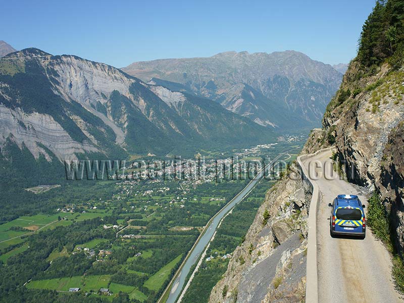
The Oisans region in the French Alps has quite a few roads not advised for drivers with acrophobia. The road leading to the village of Auris is impressive with its 600-meter vertical drop above the Romanche Valley. Le Bourg d Oisans, Isère, Auvergne-Rhône-Alpes, France.
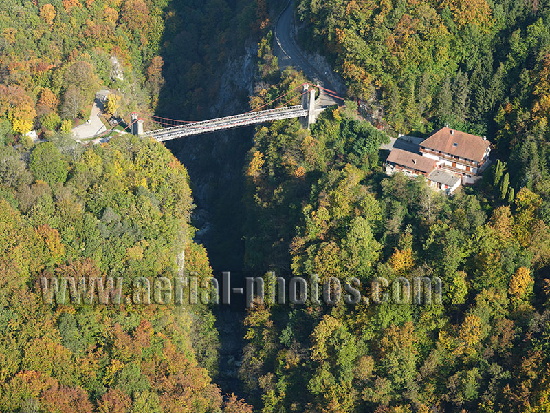
Inaugurated in 1888, the Abîme Bridge is listed in the national register of historical monuments. The suspension bridge over the abyss has always been a tourist attraction from the Belle Epoque to the present day. It crosses the Chéran Gorge at a height of 96 meters and is located in the Bauges Massif, a picturesque mountainous region labeled UNESCO Global Geopark. Cusy (left bank) and Gruffy (right bank), Haute-Savoie, Auvergne-Rhône-Alpes, France.
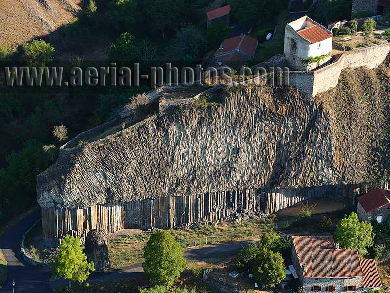
Basaltic colonnade of Chilhac. This geologic curiosity is the result of a lava flow cooling down slowly under the surface. The solidification and reduction of the lava flow causes the rock to fracture forming these interesting hexagonal columns. In this photo, the columns are recessed as some have been taken away for constructions. The colonnade underlies another layer of columns, very irregular as it was subjected a a quicker cooling being closer to the surface. Chilhac, Haute-Loire, Auvergne-Rhône-Alpes, France.

Shepherd sorting sheep in the pastures of the Vanoise Massif. The Vanoise mountains are one of the major pastoral areas in France. In the summertime, sheep and cows have plenty of alpine meadows to graze on. Agriculture and tourism are the two main sectors of the Vanoise economy. Les Belleville, Savoie, Auvergne-Rhône-Alpes, France.

The European Synchrotron Radiation Facility is a particle accelerator. It is part of the Polygone Scientifique, a large research park located at the confluence of the Drac and Isère Rivers on the outskirts of Grenoble. Isère, Auvergne-Rhône-Alpes, France.


