
Les Périades is a vertiginous arête stretching for over 1.5km with numerous pinnacles over its entire length. Les Périades’ elevation is around 3500 meters. In the distance, the Grandes Jorasses’ massive north face is visually striking with its 1200-meter-drop. Chamonix-Mont-Blanc, Haute-Savoie, Auvergne-Rhône-Alpes, France.
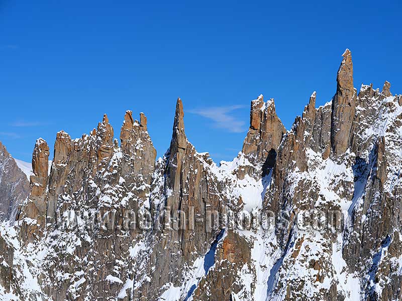
Like Mont Blanc, these rocky pinnacles are made of a 300 million-year-old granite containing ferruginous mica which gives the eroded rock its rusty color. On the right, Pointe Cupelin is the highest of them all reaching an altitude of 3549 meters above sea level. Chamonix-Mont-Blanc, Haute-Savoie, Auvergne-Rhône-Alpes, France.
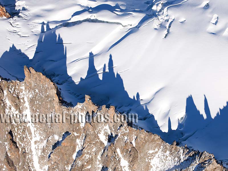
The lofty ridge is located hundreds of meters above and between the Mont-Mallet Glacier and the Périades Glacier, its height only increasing year after year as the glaciers are losing in mass due to global warming. The pinnacles are here casting their long shadows on the Mont-Mallet Glacier. Chamonix-Mont-Blanc, Haute-Savoie, Auvergne-Rhône-Alpes, France.
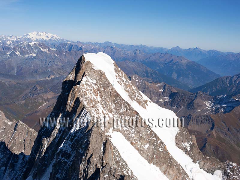
The Grandes Jorasses summit (elevation: 4208m at Pointe Walker). For alpinists in search of a challenge, the north face of The Grandes Jorasses will provide. It is one of the three toughest north face climbs in the Alps, the other two are the Eiger and the Matterhorn. Its north face (in the shade) is in France whereas the sunny side is in Italy. In the distance, 68km away is Monte Rosa, the Alps' second highest summit with an elevation of 4634 meters. Chamonix, France and Courmayeur, Italy.

Of all the iconic peaks of the Mont-Blanc Massif, the Dent du Géant (elevation: 4013m, height above its base: 160m) is the most distinctive due to its sheer height and its striking overhang. Chamonix, France and Courmayeur, Italy.
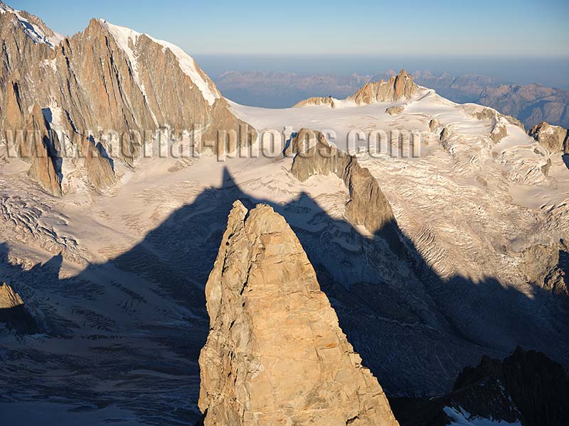
Dent du Géant (elevation: 4013 meters) casting its morning shadow on the eponymous Glacier. On the right, the Aiguille du Midi (elevation: 3842 meters) overlooking the famed Vallée Blanche. Chamonix, Haute-Savoie, Auvergne-Rhône-Alpes, France.
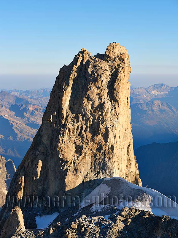
Viewed from the east, the iconic Dent du Géant does not appear slanted which is its famous trademark. On the top, 3 climbers barely visible give a sense of scale to this incredible granite peak. Chamonix, Haute-Savoie, Auvergne-Rhône-Alpes, France.
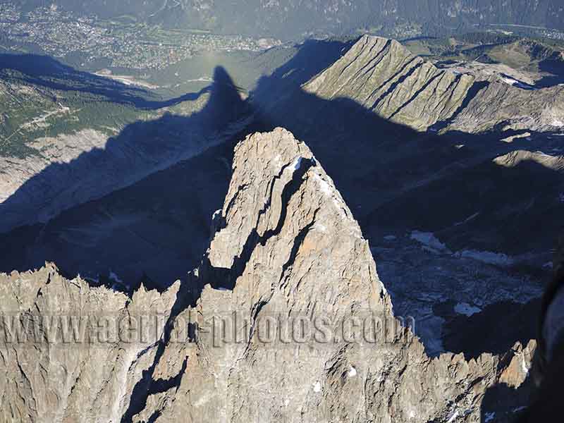
Les Drus (elevation: 3754 meters) in the morning light casting its long westerly shadow towards Les Praz (elevation: 1060 meters), a hamlet in the Chamonix Valley. This vertiginous granite peak was first climbed by a party of British alpinists in 1878. Chamonix, Haute-Savoie, Auvergne-Rhône-Alpes, France.
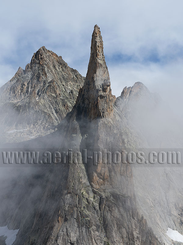
With its outstanding verticality and distinctive shape, Aiguille Dibona is one of the many iconic peaks in the Alps. Its has an elevation of 3131 meters and its generous 400-meter-high big wall makes it a favorite site for big wall rock climbers. The peak is named after Angelo Dibona, an Italian mountaineer who first climbed it in 1913. Saint-Christophe-en-Oisans, Écrins Massif, Isère, Auvergne-Rhône-Alpes, France.
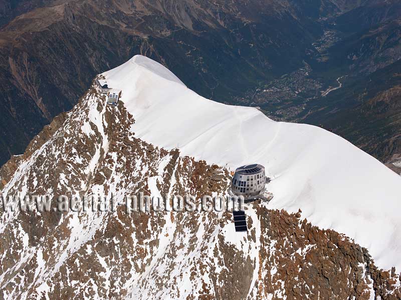
Aiguille du Goûter (elevation: 3863m) and the Goûter Hut (3815m). The new futuristic ovoid Goûter Hut was opened in 2013. It is the highest mountain hut in France, and a most welcomed respite for mountaineers on the way to the summit of Mont-Blanc. Further away, the old Goûter Hut is still standing. Chamonix-Mont-Blanc, Haute-Savoie, Auvergne-Rhône-Alpes, France.
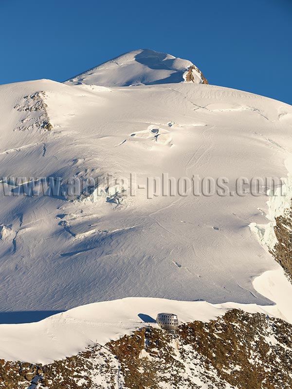
The Goûter Hut with, in the distance, the Dome du Goûter (4304m) and the lofty Mont-Blanc (4810m). There are five itineraries for mountaineers wishing to reach Mont-Blanc, the Goûter Route is the most popular. The summit is ascended by an average of 20,000 mountaineers each year. Chamonix-Mont-Blanc, Haute-Savoie, Auvergne-Rhône-Alpes, France.
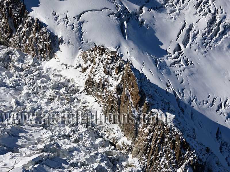
The Grands Mulets Hut (elevation: 3051 meters) is located on a rocky islet on a sea of ice. Reaching it involves climbing on a very treacherous terrain of deep crevasses. The Glacier des Bossons, which surrounds completely the mountain hut is one of the tallest glacier in the world starting from just below the summit of Mont-Blanc (4810m) and ending, in 2024, at an elevation of 1600 meters. Chamonix, Haute-Savoie, Auvergne-Rhône-Alpes, France.
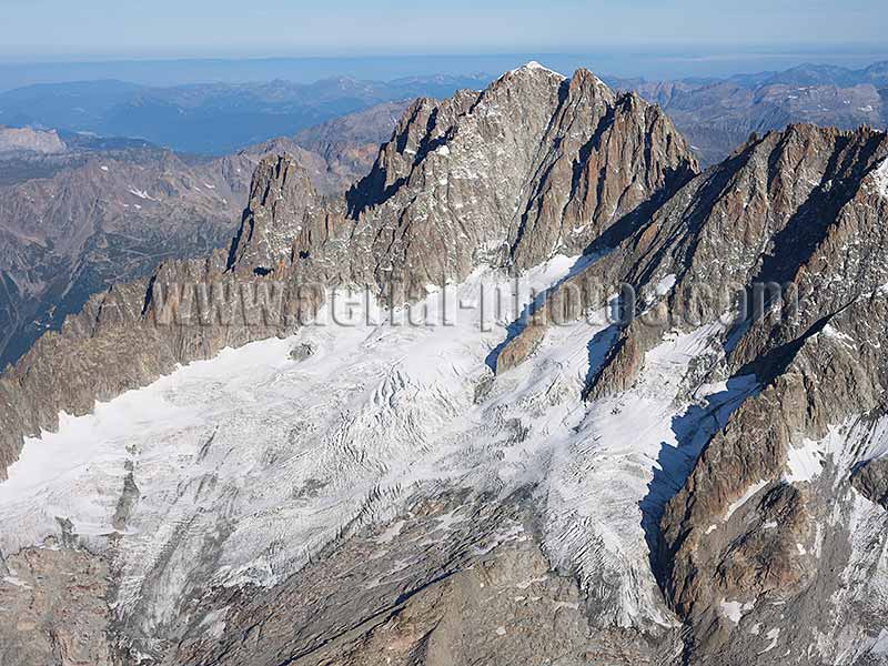
The Mont-Blanc Massif has many legendary peaks, the Aiguille Verte (elevation: 4122m) is one of them. It was first climbed in 1865 by Edward Whymper, Christian Almer, and Franz Biner. This granitic peak dominates the Talèfre Glacier. Chamonix, Haute-Savoie, Auvergne-Rhône-Alpes, France.
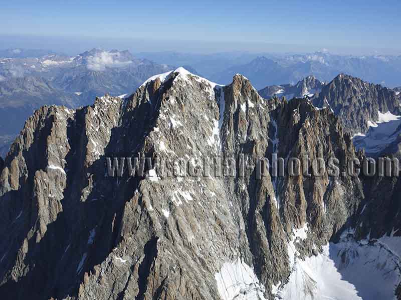
Aiguille Verte (4122m) and Grande Rocheuse (4102m), Aiguille du Chardonnet (3842m) can be seen in the distance to the right. The southern face of Aiguille Verte is known as Versant Charpoua. Famous for rock climbing, the peak in the winter is also a playground for daredevil skiers who after a hard climb will ski from the top through the vertiginous (50° slope) Whymper Couloir which starts from the pass between Aiguille Verte and Grand Rocheuse. Chamonix-Mont-Blanc, Haute-Savoie, Auvergne-Rhône-Alpes, France.
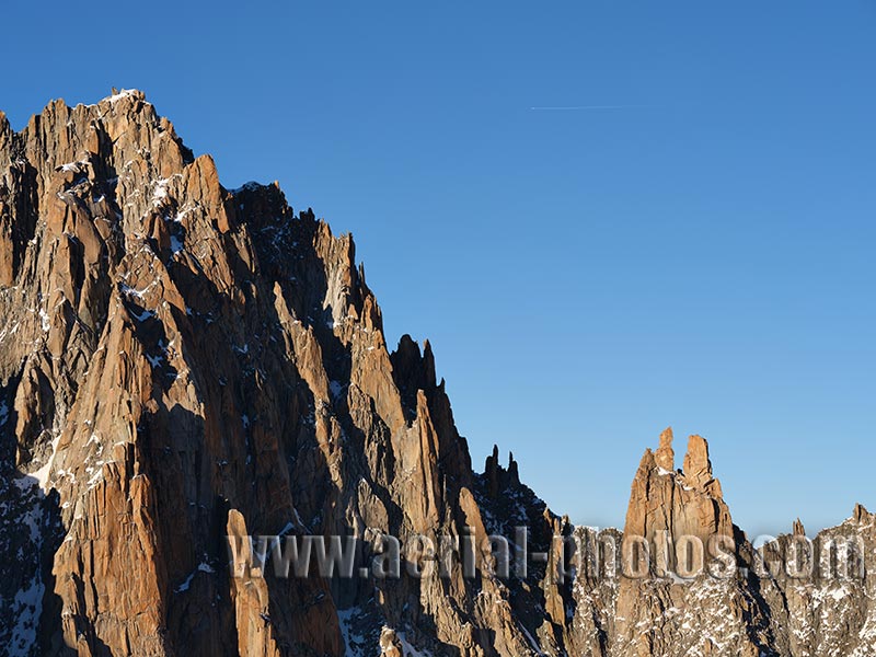
Aiguille du Jardin (4035 meters) and Col de l’Aiguille Verte, a mountain pass at 3796 meters with, in between, one of the most jagged landscape in the Mont-Blanc Massif with its many towering granite pinnacles. Chamonix-Mont-Blanc, Haute-Savoie, Auvergne-Rhône-Alpes, France.
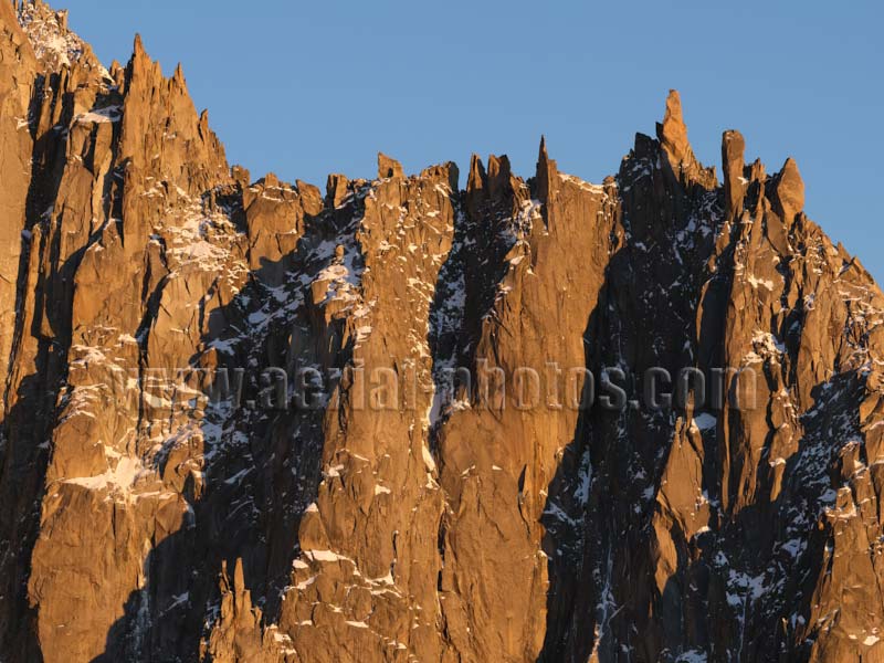
Arête des Flammes de Pierre (Stone Flames Ridge) is a stunning ridge with many granite pinnacles near Les Drus, it turns a dazzling red at sunset. Pointe Michelle-Micheline is the highest peak with an elevation of 3322 meters. Chamonix-Mont-Blanc, Haute-Savoie, Auvergne-Rhône-Alpes, France.
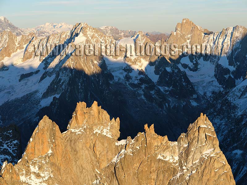
Foreground, left to right; Aiguille de Blaitière (3522 meters), Aiguille des Ciseaux (3479 meters), Aiguille du Fou (3501 meters). In the distance, Aiguille de Talètre (3730m, left of middle) and Aiguille de Leschaux (3759 meters, on the right). Chamonix-Mont-Blanc, Haute-Savoie, Auvergne-Rhône-Alpes, France.
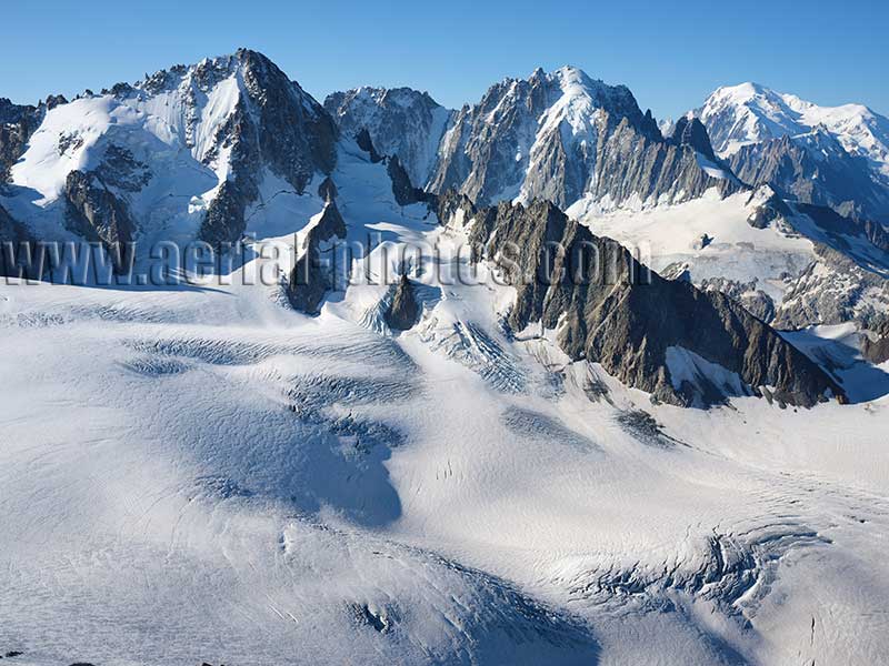
Mont Blanc Massif viewed from the north with left to right, Aiguille du Chardonnet (3824m) overlooking Glacier du Tour, Aiguille Verte (4122m) and Mont Blanc (4810m). The Mont-Blanc Massif is one the world’s most visited natural site but its northern part is less frequented as it is only accessible by hiking trails, no cable cars to reach its spectacular sights. Chamonix-Mont-Blanc, Haute-Savoie, Auvergne-Rhône-Alpes, France.
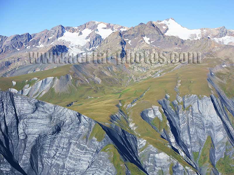
The Grandes Rousses Massif viewed from the northeast. Its highest summit is Pic Bayle with an elevation of 3465 meters. Isère and Savoie, Auvergne-Rhône-Alpes, France.

Panorama of the upper Maurienne Valley in early summer. In the distance, a sea of clouds blankets the Po Valley in Italy. Auvergne-Rhône-Alpes, France.


