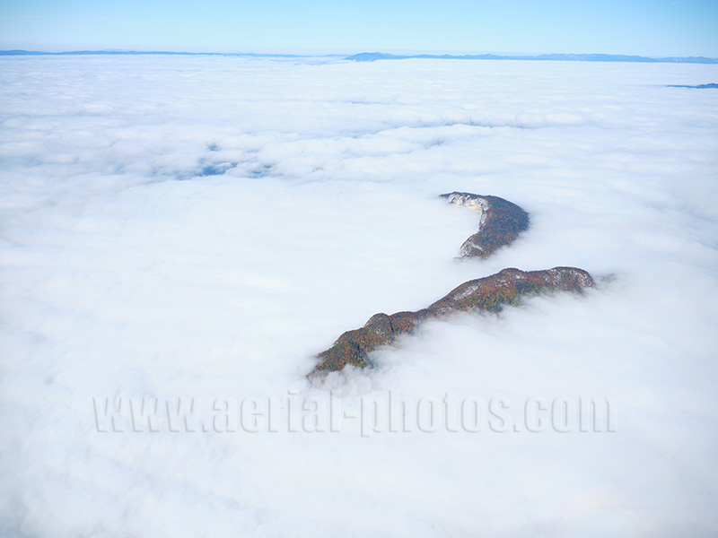
Mont Veyrier (furthest summit, elevation: 1291 meters) and Mont Barret (1243 meters) emerging from a sea of clouds in the early morning. The two mountains are on the right bank of Lake Annecy and are quite impressive viewed from the lakeshore at an elevation of 447 meters. Veyrier-du-Lac, Haute-Savoie, Auvergne-Rhône-Alpes, France.

Mont Veyrier (half-moon shaped) and Mont Barret are separated by the Col des Contrebandiers (Smuggler’s Pass) at an altitude of 1052 meters. The parking at the pass is the easiest way to access the summit with its stunning views of Lake Annecy to the west and the Bornes Massif to the east. Veyrier-du-Lac, Haute-Savoie, Auvergne-Rhône-Alpes, France.
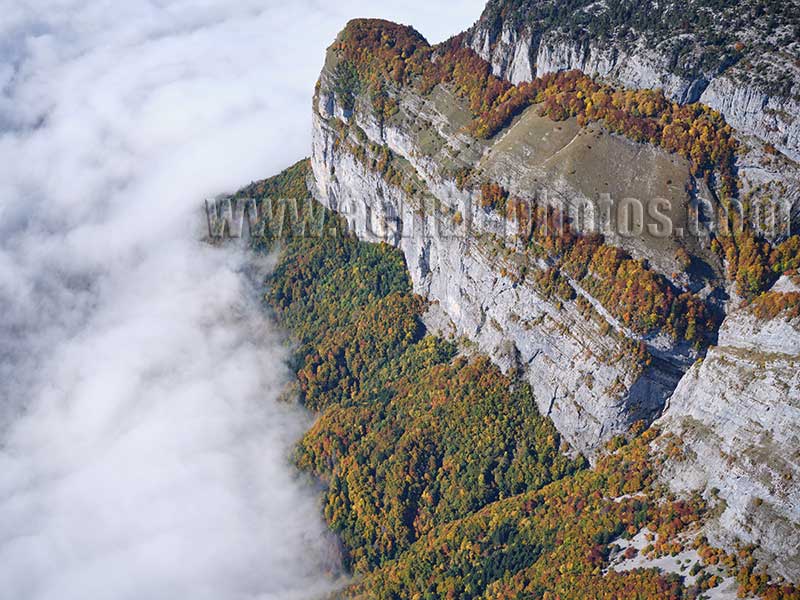
Tête à Turpin (1541 meters) is a rocky promontory overlooking the Fier Valley in La Balme-de-Thuy hidden here by the low-lying morning fog. The mountain in the western Bornes Massif is a popular climbing spot. La Balme-de-Thuy, Haute-Savoie, Auvergne-Rhône-Alpes, France.
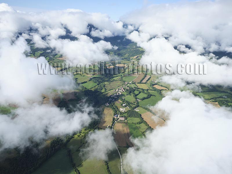
Village of Percy being beautifully framed by clouds. The village is in the Trièves Region, an alpine area of farmlands surrounded by high mountains on all directions. Percy, Isère, Auvergne-Rhône-Alpes, France.
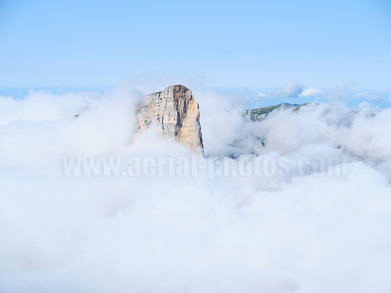
Southeastern face of Mont Aiguille shrouded in early morning fog. Isère, Auvergne-Rhône-Alpes, France.
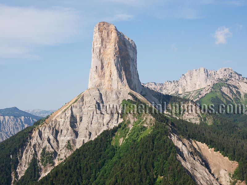
Once part of the Vercors Plateau, the relentless forces of erosion have separated and isolated this lofty limestone butte. The 2087-meter-high butte lies within the Vercors Regional Natural Park. This butte with its vertiginous big walls standing a good 1000 meters above the meadow was the site of the first recorded exploit in rock climbing. This historical first happened the same year Christopher Columbus discovered America (in 1492), quite a feat regarding the climbing gear of the time. Northeasten face of Mont Aiguille, Isère, Auvergne-Rhône-Alpes, France.
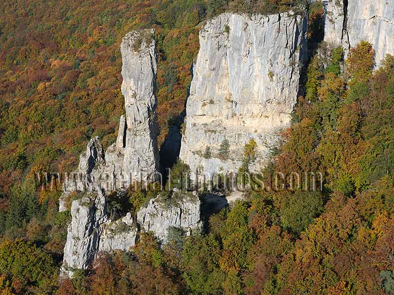
The Tours Saint-Jacques are a geologic curiosity in the Bauges Massif. These limestone monoliths were detached by sliding from the main limestone cliffs of Fontanil located above. Allèves, Haute-Savoie, Auvergne-Rhône-Alpes, France.
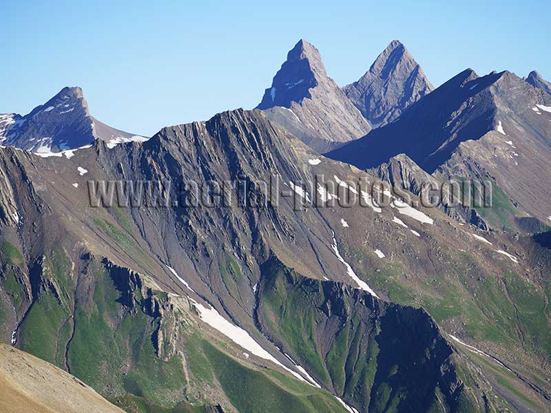
The Aiguilles d’Arves with 3514-meter-high Aiguille Méridionale (left) and 3513-meter-high Aiguille Centrale (right). Valloire, Savoie, Auvergne-Rhône-Alpes, France.
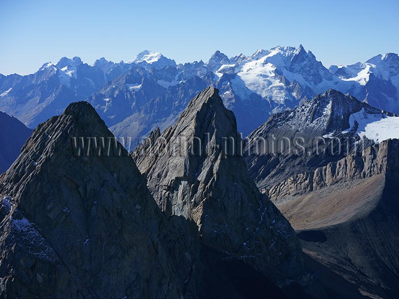
Les Aiguilles d'Arves (left: Aiguille Centrale, 3513m and middle: Aiguille Méridionale, 3514m) with the Ecrins Massif in the distance. Saint-Jean d'Arves, Savoie, Auvergne-Rhône-Alpes, France.

The Mount Falcon is a 2625-meter-high summit in the Arves Massif, left in the distance are the three Aiguilles d'Arves. Albiez-Montrond, Savoie, Auvergne-Rhône-Alpes, France.
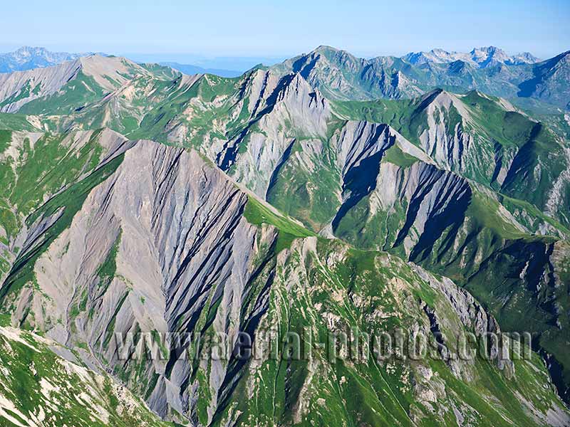
Landscape of alpine toundra and ravines in the Encombres Valley in the western Vanoise Massif. Les Belleville, Savoie, Auvergne-Rhône-Alpes, France.
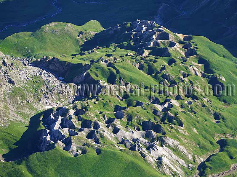
Visually reminiscent of a crater field of War World I, these craters have a geological origin. They are found in scattered places in the Alps where the rock is gypsiferous. They are sinkholes formed by the collapse of an underground chamber and / or the chemical dissolution of the gypsiferous rock. This field is approximately 750 meters in length and some sinkholes can reach a diameter of up to 30 meters. Les Gyspsières (elevation: 2300 to 2400m amsl), Valloire, Savoie, Auvergne-Rhône-Alpes, France.
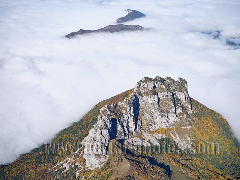
Dents de Lanfon (1824m) is a picturesque limestone butte high above Lake Annecy (447m). In the distance, emerging from a sea of clouds, Mont Veyrier (1291m) and Mont Baret (1243m) can be seen. Dents de Lanfon is a prime destination for hikers and rock climbers. Lake Annecy is one the world’s greateat destination for paragliding. The take-off area can be seen at the foot cliff. Alex, Haute-Savoie, Auvergne-Rhône-Alpes, France.
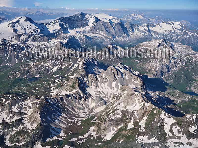
Vanoise Massif viewed from the north with Grande Motte (3653m, in the distance left) and Grande Casse (3855m, in the distance left of middle). Grande Motte in Tignes is one the four ski resorts (as of 2023) in France where the altitude allows summer skiing. There are 20 kilometers of ski runs between 2724 et 3456 meters on the Grande Motte Glacier. With 732 meters, this is the most important vertical drop of the four ski resorts. Champagny-en-Vanoise, Savoie, Auvergne-Rhône-Alpes, France.
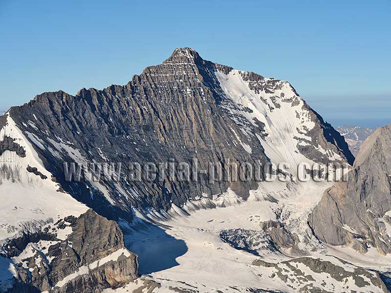
La Grande Casse viewed from the north is the most impressive with its 600-meter-high face. With an elevation of 3855 meters it is the highest peak in the Vanoise Massif and in the Vanoise National Park. The first ascent was made in 1860 via the southwest face and in 1933 via the north face. Champagny-en-Vanoise, Savoie, Auvergne-Rhône-Alpes, France.
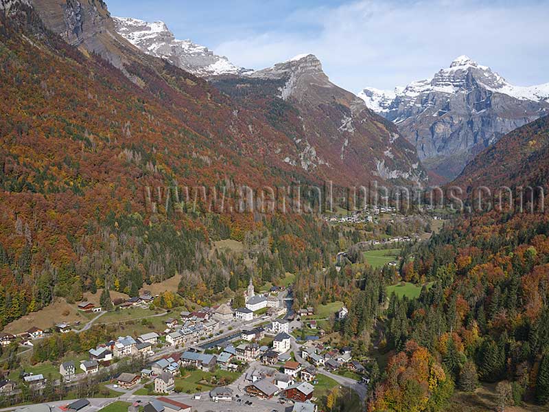
Sixt-Fer-à-Cheval is a picturesque village in the heart of the Giffre valley. This valley, which has remained authentic, is not subject to the real estate pressure that affects its famous neighbor, the Arve Valley with Chamonix. Sixt-Fer-à-cheval, Haute-Savoie, Auvergne-Rhône-Alpes, France.
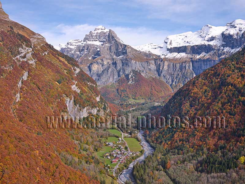
The upper Giffre Valley ends abruptly in a spectacular amphitheater of vertiginous limestone cliffs. This site is called the “Cirque du Fer-à-cheval” which translate as the cirque of the horseshoe. On the right bank of the Giffre River, at an altitude of 843 meters, the hamlet of Nambride is dominated by peaks approaching 3000 meters. Sixt-Fer-à-cheval, Haute-Savoie, Auvergne-Rhône-Alpes, France.
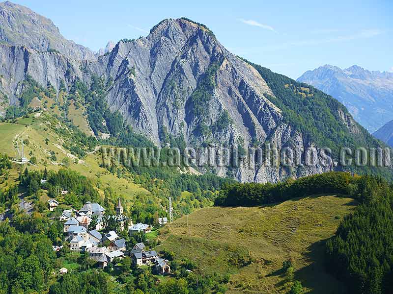
Ornon (1243m) is a hamlet near Col d’Ornon (1360m), which is a less-traveled mountain pass between the Romanche Valley and La Bonne Valley. In the distance, Crête de la Brèche (1730m) provides a picturesque setting to this unpretentious hamlet. Ornon, Isère, Auvergne-Rhône-Alpes, France.
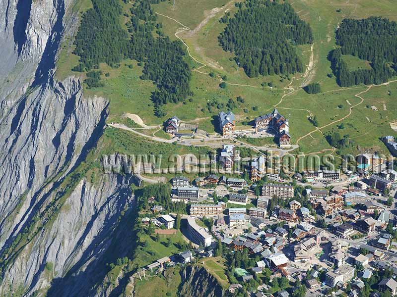
With 227km of ski slopes, Les Deux Alpes is one of the largest ski resort in the Alps. The town, on its southern outskirts, stands on the edge of a precipitous cliff. Oisans, Isère, Auvergne-Rhône-Alpes, France.
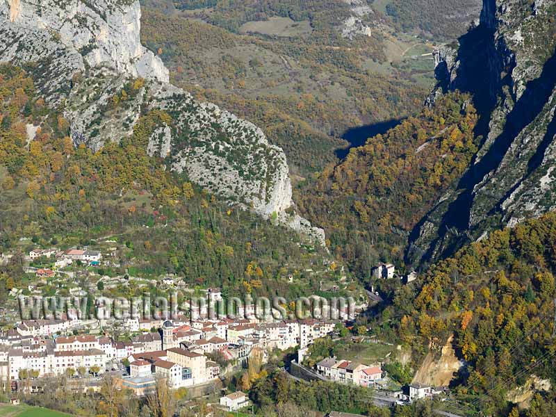
Pont-en-Royans is a medieval village at the western gateway to the grandiose La Bourne Gorge and the equally grandiose Vercors Plateau. Isère, Auvergne-Rhône-Alpes, France.


